Landscape
General
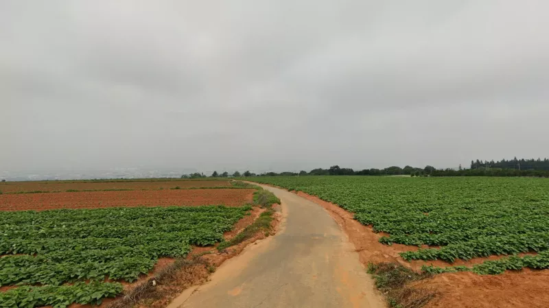
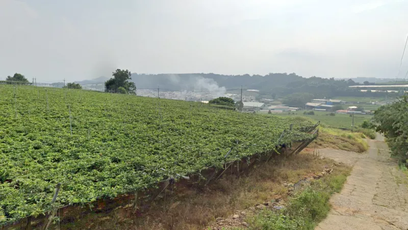
Red soil is rare in Taiwan, being found almost exclusively in western Taichung county, on a slightly raised plateau centred around Taichung International Airport. This area will have slightly undulating terrain, unlike the rest of the western plain, and it is common to find pineapple growing here. In an urban setting, red soil can be found in Taoyuan and Linkou District (林口區) west of Taipei. However it is rare to see the soil layer in those areas. Note also that the Taichung plateau then continues beyond the Dadu river(大肚溪) into Changhua province which has a lower ridge of its own. Here you will also find reddish soil and pineapple, but the landscape is notably flatter.
The only other area with large amounts of red soil is on the western side of the southern tip, in Hengchun township (恆春鎮). This area is much grassier, and the mountains to the east will be a lot closer than they appear from the Taichung plateau.
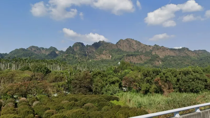
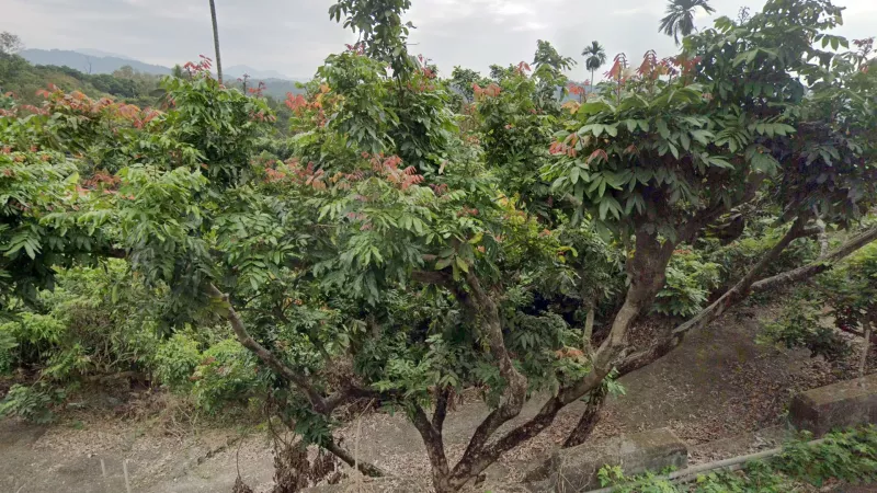
Huge areca plantations in a hilly landscape are common in eastern Chiayi, and more rarely in western Nantou. These can even stand out from a distance.
Plains
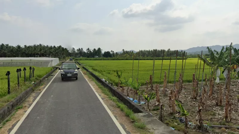
The Taoyuan plain is the largest non-urban expanse of flat land in the north. There are a number of different ways to distinguish it from the main western plain:
* Nearer to Taoyuan city you’ll sometimes see some fields with orange soil.
* Clumps or rows of bamboo are very common among agricultural fields here.
* Two-storey houses among the fields - in the western plain you would typically only see sheds, or older one-storey houses outside of towns/villages.
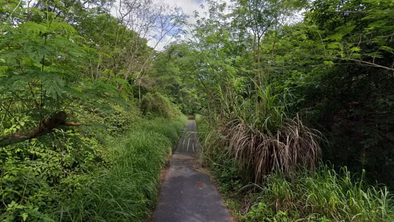
* White flowers (Bidens alba) are very common along roadsides here.
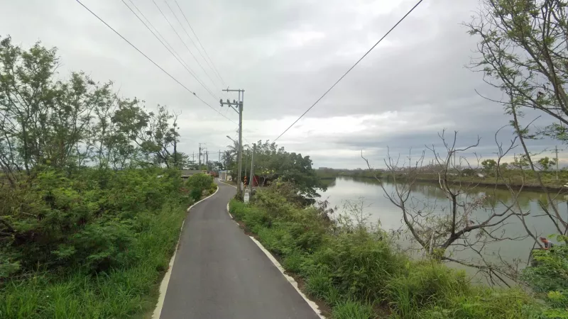
* Small reservoirs are common here, so if you find yourself next to a raised embankment you are likely in the Taoyuan plain.
* You will sometimes be able to see a low ridge to the south, which is not possible anywhere else.
* Nearer to Taoyuan city you’ll sometimes see some fields with orange soil.
* Clumps or rows of bamboo are very common among agricultural fields here.
* Two-storey houses among the fields - in the western plain you would typically only see sheds, or older one-storey houses outside of towns/villages.
* White flowers (Bidens alba) are very common along roadsides here.
* Small reservoirs are common here, so if you find yourself next to a raised embankment you are likely in the Taoyuan plain.
* You will sometimes be able to see a low ridge to the south, which is not possible anywhere else.
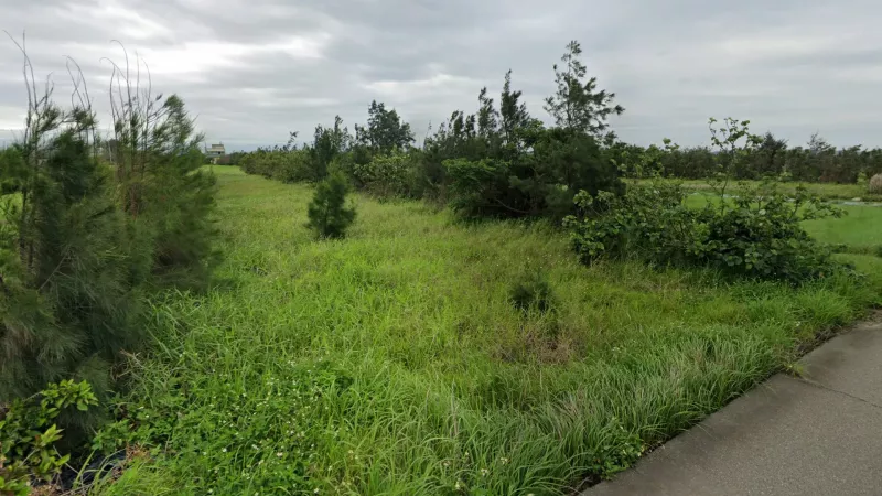
The smaller Houlong plain in Miaoli county is very different from either the western plain or the Taoyuan plain, being divided into much thinner, grassier fields, separated by rows of she-oaks.
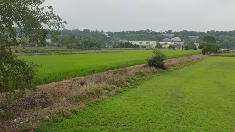
The northern terminus of the great western plain is in northern Taichung, in an area between two large rivers consisting of Houli (后里), Waipu (外埔), Dajia (大甲) and Da’an (大安) districts. This part of the plain is not deadflat, but rises very gradually toward the east, with fields appearing slightly raised above one another. Here you sometimes have a clear view of slight ridges to the south (Taichung plateau) and north as well, including the highly distinctive Houyan mountain, which can be helpful for pinpointing with its eroded, orange sides.
The Taitung plain is the only flat area in the southeast of the country. It is distinct from other eastern plains as the majority of the land here is dedicated to growing various tropical fruits. You can find almost anything growing here, so with any crop listed in the agriculture section, assume it can also be found in Taitung. Even in the absence of fruit trees, the Taitung plain is also noticeably grassier.
Roughly in the centre of the country is the Puli plain, the only large flat area within the mountains. If it isn’t already obvious from the presence of higher altitude on all sides, the Puli plain can also be identified through the abundance of greenhouses and pine plantations. Rice fields look different here as well, with the fields placed directly next to the road and the rice itself growing taller than in other areas.
Just north of the Puli plain is a second smaller plain which can be harder to identify topographically as it’s surrounded by much lower hills. Nonetheless, almost the entirety of it is covered in passionfruit plantations in an undulating landscape, making it unmistakable. Passionfruit is easy to identify as it grows as vines on a raised grid made of plastic piping.
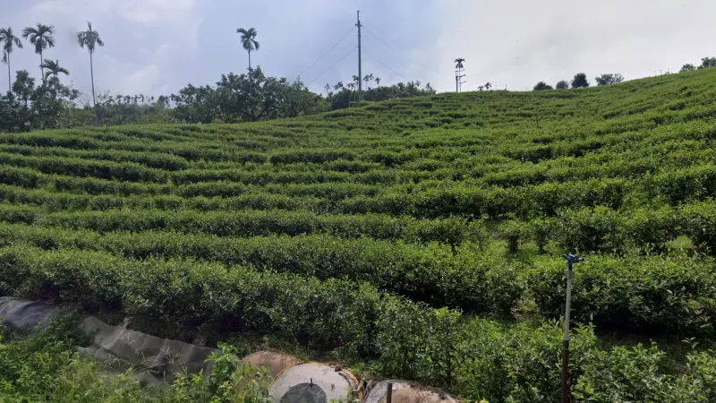
Mingjian Township (名間鄉) in western Nantou county consists of a slightly undulating plain with orange soil covered in tea and pineapple plantations, a combination not found anywhere else. It is also essentially the only flat tea-growing area of the country.
Compared to the rest of the western plain, eastern Changhua county has a more complicated agricultural landscape with lots of tree plots, flower farms, greenhouses and black netting, all of which can give a more crowded feeling than the rice or corn landscapes in much of the rest of the plain. The decorative trees and black netting specifically are generally limited to this area.
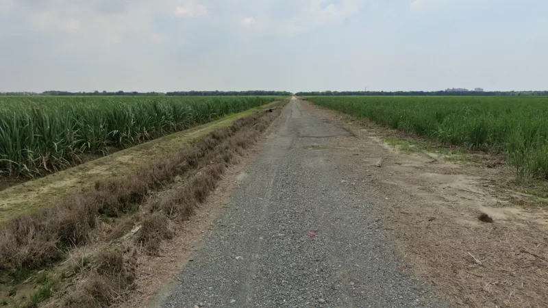
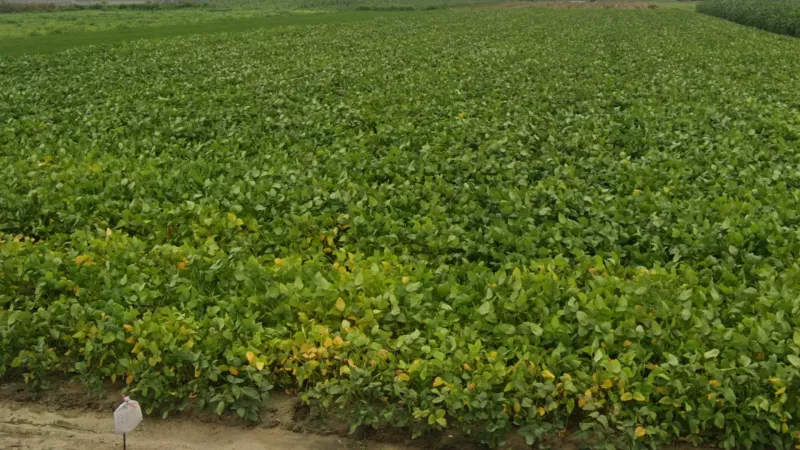
While crop fields are usually very small in Taiwan, there are some areas which host very large fields. These are usually used to grow sugar cane or sometimes soy beans, and they make great bait rounds as infrastructure clues are often not visible. These are mostly found in western Chiayi with some extending into western Yunlin and Changhua. They can also be found in Pingtung, however mountains will always be visible, as opposed to those in the western plains. Note that large fields of soybeans are exclusive to Pingtung.
Towards the north of the Hualien valley, you will often get these unusual reforested flat forest rounds, almost always in a grid formation. If you see long, straight and very narrow roads in a flat but densely forested landscape, you are almost certainly in this area. Note that in older coverage you will see these forests in their early stages.
Mountains
In the southeast part of Tainan county, leaking southwards into Kaohsiung, you’ll find a unique landscape of ‘forested badlands’, with steep but low sandy hills pointing out from the dry forest. Sandy soil is also dominant, but not as unique. This generally coincides with the districts of Zuozhen (左鎮區), Longci (龍崎區) and Tianliao (田寮區).
Yangmingshan (陽明山) is a volcanic massif on the northernmost tip of the main island. It is one of the rainiest parts of the island, meaning plants like giant taro and Chinese silver grass are far more abundant here. It is worth considering this area when you see a more conical mountain in only one direction, as it is not part of a wider chain.
Miaoli county is bisected by a NNE-SSW oriented ridge with low but somewhat pointed peaks. This can be useful for telling apart western Miaoli from similar looking parts of Hsinchu and Taoyuan. The pointed peaks are even more notable from the other side.
Near Guoxing (國姓) in northwest Nantou, you’ll find a small geologically distinct set of mountains that appear more splintered and pointy than usual. These are very useful for identifying the plain around Caotun (草屯), and can even be seen sometimes from the area south of Taichung City. If you can get a close view of them you’ll notice they are slightly redder than typical mountains.
Towards the northeast corner of the island, just east of Jiufen (九份) (Ruifang District 瑞芳區) there are several roads that traverse above the tree line, resulting in far more open landscapes with wide views. Unlike high mountain roads in Nantou, the vegetation is not piney, and silvergrass dominates the roadside.
The Hai’an range runs between the Hualien Valley and the Pacific ocean. Towards its southern end in Taitung county, it splits into two parallel northeast-southwest ridges with a ‘bowl’ in between. Aside from the enclosed topography, this area is notably very lush, with lots of arecas, bananas, breadfruit and arenga palms, as well as lots of large boulders and exposed cliffsides in the valley. It is also far less densely populated than similar-looking valleys in the southwest.
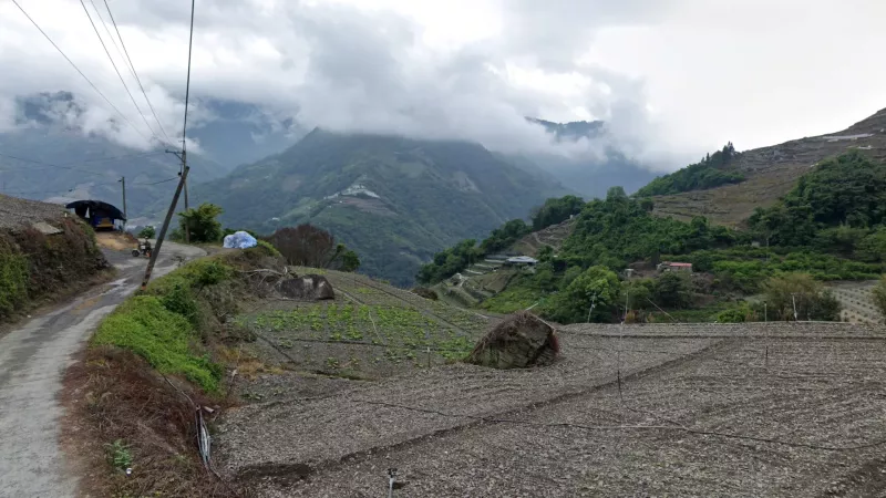
Within the central mountains, there is a cluster of roads and villages in Ren’ai township(仁愛鄉) in the northeast of Nantou county. Here you’ll find steep agricultural terraces among tall, often shrouded mountains. Lettuce and cabbage are common crops on these terraces.
Valleys
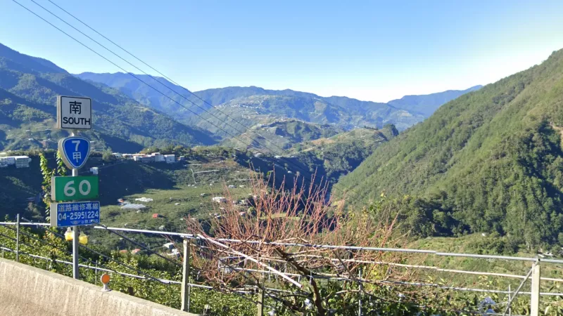
Northeast from Ren’ai (仁愛), extending into far-eastern Taichung, you’ll find the Dajia valley (大甲溪) flowing northeast to southwest (Provincial Highway 7甲 runs parallel to it). The landscape here is somewhat similar to Ren’ai, with lots of cabbage fields in a mountainous landscape. However the mountains are generally less extreme and there is a clear NE-SW orientation to the landscape. The roads and villages often follow low ridges entirely within the valley.
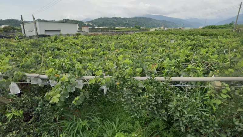
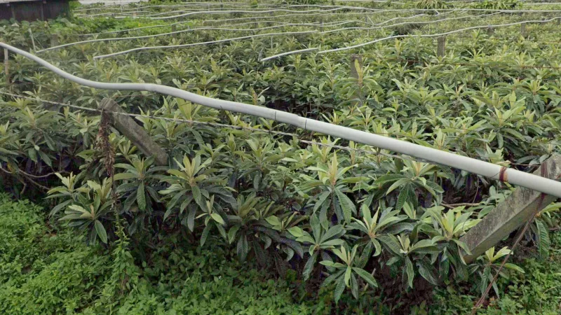
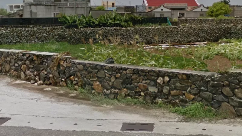
The Dajia river (大甲溪) flows down the length of Taichung county, however before exiting into the western plain it forms a valley coinciding with the borders of Dongshi (東勢) and Xinshe (新社) districts. This valley is densely agricultural, with various crops grown there including loquat, citrus and grapes, very often covered in netting or contained in packed greenhouses. These greenhouses have a distinctive design with a raised roof part (this can be wider and more subtle than that shown in the first image). In combination with the surrounding low mountains, this valley can be very distinctive.
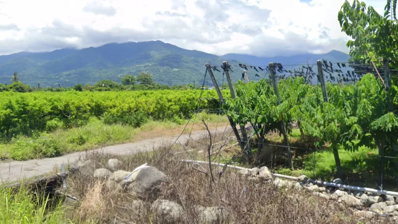
The Chenyoulan valley (陳有蘭) is the largest north-south valley in the country (after Hualien) and is lined with some of the tallest mountains in the country. It is particularly recognisable as it is full of vineyards and areca groves.
The Zhongshui river (中水溪, lit. ‘middle river’) empties out into the strait of Taiwan roughly in the middle of the island. Before exiting Nantou county for the western plain, it forms a flat area encased by mountains, some to the south quite large, with extremely diverse agriculture. Dragonfruit, papaya, passionfruit, arecas, citrus and lychee are all common sights here.
The Qishan valley (旗山溪) is the only enclosed flat valley in the south of the country. It is surrounded by low- to moderately tall mountains, flows northeast to southwest, and is full of tarp-covered fields, palm groves, and banana plantations, which you would not normally see in valleys in the north of the country. It is covered by Qishan (旗山)and Shanlin (山林) districts in northern Kaohsiung.
In Nanxi district (楠西區) in far-eastern Tainan, as well as adjacent parts of Kaohsiung county, you can find a couple of parallel valleys distinguished by their frequently exposed sides composed of weak clay soils, somewhat similar to the nearby sandy hills. All these valleys have a northeast to southwest orientation.
Spotlight
At the very southern tip of the main island, in Kenting (墾丁) and Longpan (龍磐) parks, you can find prominent volcanic plugs with exposed stone, something not found elsewhere in Taiwan.
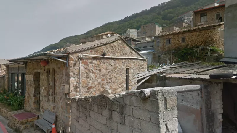
Liuqiu island (琉球嶼) lies south of Kaohsiung and is administratively part of Pingtung province. It has a unique undulating landscape covered in coastal bushland, primarily white leadtree (Leucaena leucocephala) - while this tree is not unique to the island, it does not dominate the landscape like this anywhere else. Urban locations on the island will generally feature traditional houses made of worn, dark grey stone, and more modern tourist apartments.
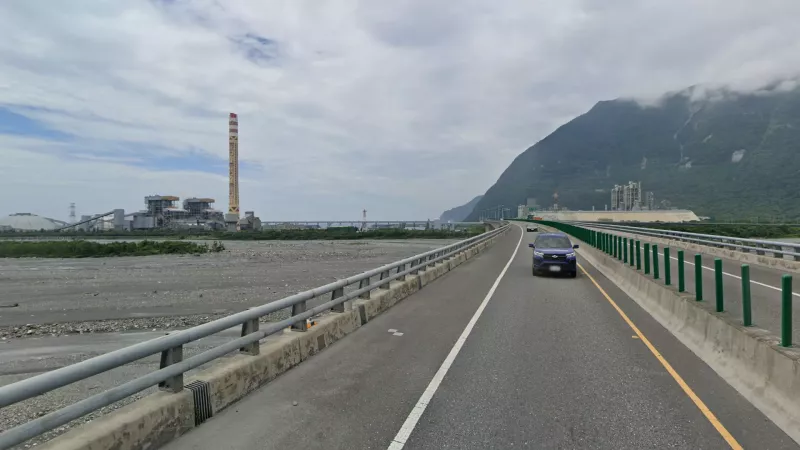
Where the border between Yilan and Hualien counties meets the sea, you will find a small but extremely recognisable delta plain. It is characterised by a wide rocky floodplain, towering mountains inland, and a huge power plant with a chimney covered in traditional aboriginal art.
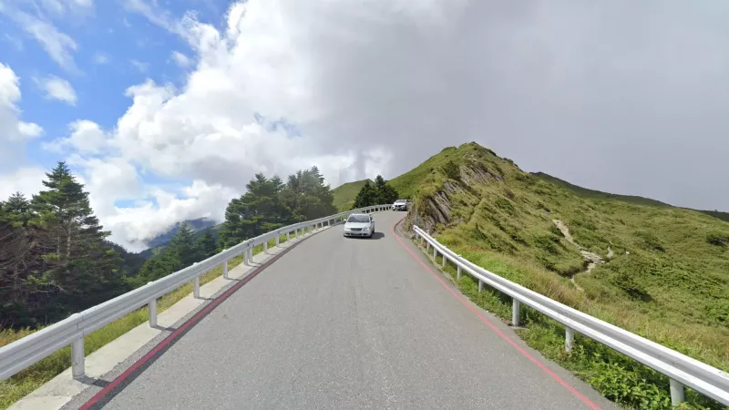
Hehuanshan (合歡山) has the highest altitude road in Taiwan and is the only spot that lies above the tree line. If you see grassy mountaintops with forests of cedars and junipers below you should be on this stretch of Provincial Highway 14 along the border between Hualien and Taichung.
Shoushan (壽山) is an isolated hill located between Kaohsiung City and the west coast. It is visible as a low green ridge to the west from many points in the city, something not found in any other city in Taiwan.
Taiwushan (太武山) is the highest point on Kinmen and is helpful for identifying the eastern half of the island. It is a low hill with lots of exposed patches of smooth stone. This is also not something you would see on the main island.
Taijiang National Park (台江國家公園), unlike most of the waterplot landscapes along the southwest coast of the island, is a natural wetland. While it has undergone a lot of human interference, it is notably greener than other waterplot landscapes, and features more non-linear waterways. It is located just west of Tainan City, and the skyscrapers of the city can sometimes be seen from the park.
The Aogu Wetlands and Forest Park (鰲鼓濕地森林園區) is an artificial peninsula in the northwest corner of Chiayi county which is covered in a she-oak forest. The roads here are oriented in a north-south grid. Irrigation canals are often visible.
In the hills around Keelung and to some extent east of Taipei, it is common to find more recently constructed neighbourhoods composed of identical-looking buildings, usually with steep streets, and surrounded by forested hills.
Vegetation
Japanese red cedar (Cryptomeria japonica) is a well-known and very distinct cedar species that also grows abundantly in parts of Taiwan. It only grows at higher altitudes in the northern half of the country, being particularly common in the high mountain areas of Miaoli and south of Taipei. However it is also commonly found in the Alishan (阿里山) tourist and tea-growing area in Chiayi county. In addition, there is a unique cedar forest in the crater of Yangmingshan (陽明山), where it grows in a comparatively much more open landscape.
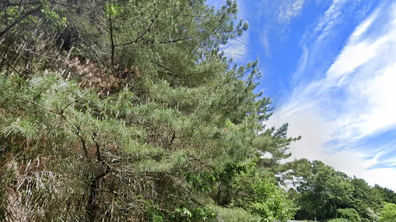
Taiwan red pine (Pinus taiwanensis) is the most common pine species in Taiwan, with notably pale needles compared to other conifers on the island. It is almost always found at very high altitudes, limiting its range to a small selection of areas in the mountainous centre.
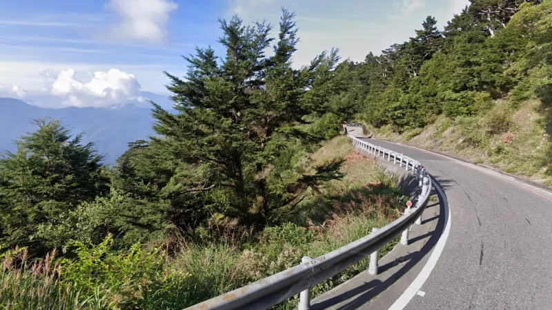
Formosan Juniper (Juniperus formoscana) only grows at the very highest altitudes (>2,000m). Therefore its presence on normal road coverage can only point you to a couple specific areas, namely the Hehuanshan area on Provincial Highway 14甲, the highest points of Provincial Highway 20 on the Taitung-Kaohsiung border, and rarely on Provincial Highway 18 near Yushan, Taiwan’s highest peak.
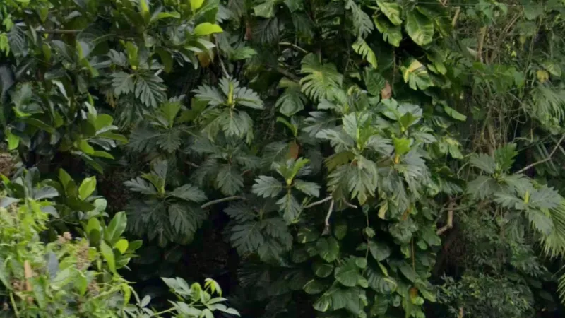
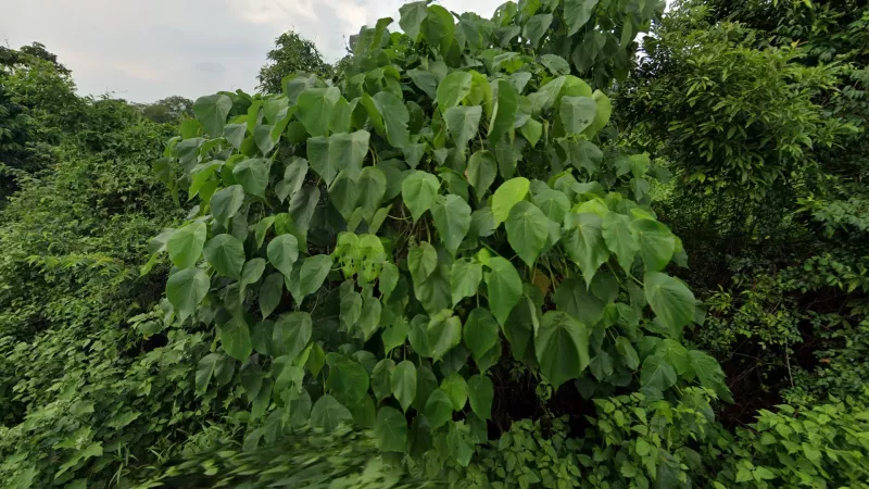
Breadfruit (Artocarpus altilis) is a tropical fruit tree with highly identifiable large deeply-lobed leaves. It is much more common on the Pacific coast of Taiwan as well as Orchid Island and Green Island. Note that younger trees will appear significantly less lobed.
Broad-leaf fern (Dipteris conjugata) is a unique disc-shaped fern species made of radiating leaves that split in half at the tips. You will sometimes see this plant in the lush forests of the northeast, and it is essentially never found outside of the far north of the country.
Parasol leaf tree (Macaranga tanarius) is commonly seen in the south of the country and is recognisable by its decently-sized tear-shaped leaves and the fact that the leaf stalk is attached to the inside of the leaf blade as opposed to the side of it.
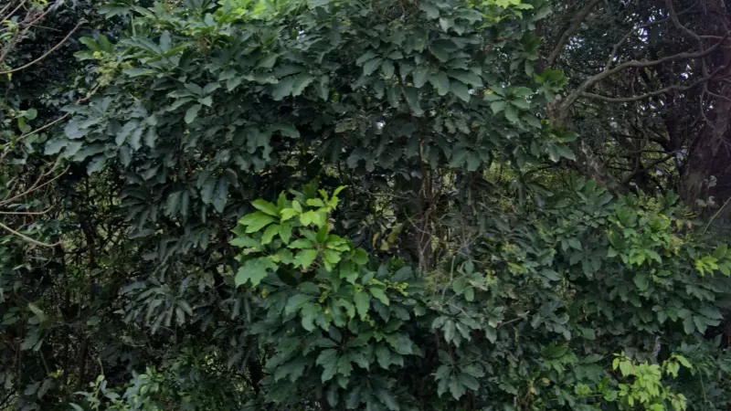
Ivy tree (Heptapleurum heptaphyllum) can be identified by its unique leaves where several thin leaflets with creased edges and long stalks radiating from a single point, creating a fan-like appearance. It can be found in the north of the country.
Sea mango (Cerbera manghas) is a common plant in forest rounds that are very near the coast. It can therefore be valuable to identify coastal areas when the view of the ocean is blocked. Because of the distribution of coastal forests in Taiwan, it can also rule out the western coast of the island. The tree is recognisable for its bunched leaves radiating from a single point, as well as small mango-like fruit when the season is right.
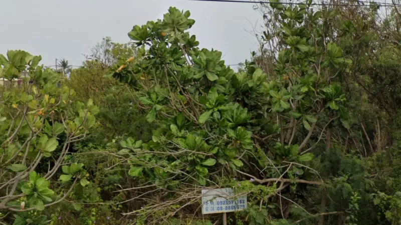
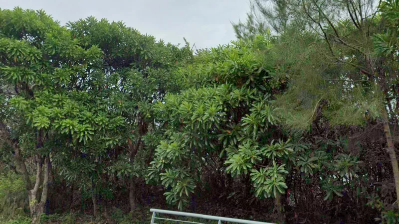
Sea almond (Terminalia catappa) has very distinctive clusters of large ovoid leaves emanating from a single point. It is a good indicator of the far south of the country, where it is far more common.
Agriculture
Tea is common in a handful of areas in Taiwan:
* In a flat area tea mostly only found in Mingjian township (名間鄉), usually next to pineapple fields
* Tea in a relatively flat area with small hills can be found sporadically in much of Hsinchu, leaking into Taoyuan.
* Tea in a gentle north-south valley should point to Tongluo township (銅鑼鎮) in Miaoli county.
* Tea amongst moderately tall, densely forested hills is found in Pinglin District (坪林區) of New Taipei, the northernmost tea producing region
* Tea among the mountains, often paired with groves of areca palms, is common in Lugu and Zhushan townships (鹿谷鄉, 竹山鄉) in the southwest of Nantou, leaking somewhat into Chiayi, particularly Meishan township (梅山鄉), where the most mountainous fields are found.
Aside from the aforementioned Taichung plateau and Mingjian township, there are a couple other pineapple-growing areas:
* Dashu district (大樹區) east of Kaohsiung - this area does not have the orange soil that characterises most other areas.
* Guanmiao district (關廟區) just east of Tainan city - often with somewhat dry, sandy soil
* Minxiong township (民雄鄉), Chiayi county - more orange soil, lacks the tea plantations of Mingjian or the deep red soil of Taichung
* Dalin township (大林鄉), near Minxiong on border with Yunlin - small but tricky area, generally lacks orange soils
* Eastern edges of the Pingtung plain - typically alongside areca plantations
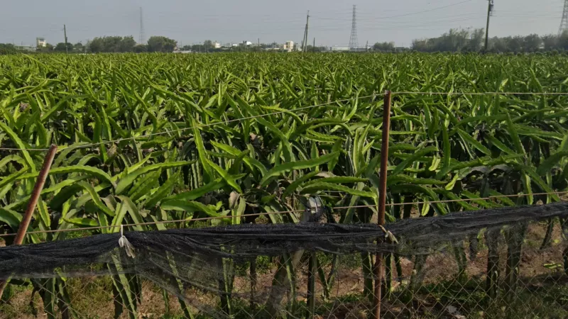
Dragonfruit can be found growing in much of Taiwan. However, it is not generally found north of Taichung, and within the western plain it is far more common in Changhua county, especially Erlin township (二林鎮) in the southwest. There is also a large cluster in northern Tainan; however, it will appear closer to the mountains than the Erlin cluster, and it is common in the aforementioned Zhongshui Valley (中水溪) in western Nantou.
Vineyards can be found in a couple different areas in Taiwan. As mentioned previously, they are very abundant in the Chenyoulan valley (陳有蘭溪) in Nantou. However, they are also common in two more areas: Changhua county and the Da’an valley (大安溪) between Miaoli and Taichung counties.
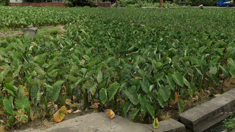
Taro (a.k.a ‘Elephant’s Ear’) forms these very recognisable water fields with large low-growing leaves covering the water’s surface. It is most common in central Miaoli and the riverine parts of Taichung, as well as near Hualien city, with smaller clusters in Linnei township (林內鄉), Yunlin and Gaoshu district (高樹鄉), Pingtung. Note that lotus ponds can look similar but are not part of the same meta - lotus leaves are typically larger and flatter.
Citrus trees can be found in many counties, but the largest concentrations are mainly found in the inland hilly areas of southwest Taiwan, in Yunlin, Chiayi and northern Tainan. Smaller plantations are also very common in Hsinchu and Taichung as well, and there is a large cluster of them in the middle of the Hualien valley around Ruisui (瑞穗), with a more limited presence in Yilan and northwest Pingtung.
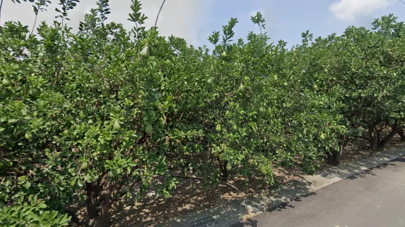
Pomelo is primarily grown in Madou district (麻豆區), north of Tainan. When it isn’t fruiting it can be hard to distinguish from other citrus trees; however, if you see the fruit itself it is clearly different, being much larger with a more pear-like shape.
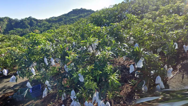
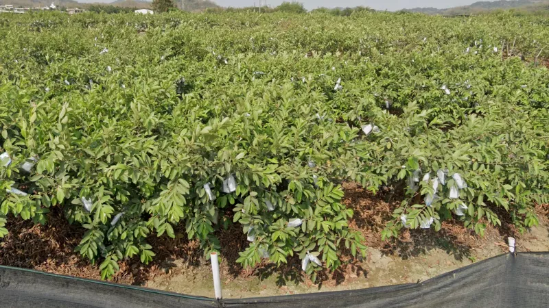
Mango plantations are extremely common in eastern Tainan county, with Yujing district (玉井區) being the centre of production, although they are relatively common in much of the inland southwest. Vast fields can also be found in the southeast of the Pingtung plain, although note that smaller plantations can occasionally be seen randomly across the south and as far north as Taichung. Aside from the characteristic spear-shaped leaves and fruit, mango farms almost always use protective bags to grow the fruit in, which are not seen on closely related fruit trees like lychee and longan.
Longan is a fruit closely related to lychee, distinguished by its slightly larger, flatter leaves that turn pink in some seasons. Both trees produce hanging clusters of small fruit; however, lychee turns red when ripe, whereas longan is always brown. Production is mostly centred around Wufeng district (霧峰區), Taichung and Zhongliao township (中寮鄉), Nantou, with some production just east of Chiayi also.
Loquat, a.k.a Japanese plum (Eriobotyra japonica) is a fruit tree distinguished by its long laurel-like leaves and frosted tips. Unlike certain lookalikes like lychee, it only grows as small trees. Loquat production is essentially exclusive to Taichung, mostly in the aforementioned Lower Dajia Valley in Xinshe district (新社區) but also in a hilly setting in Taiping district (太平區).
When found in large plantations, guava is pretty much exclusive to Yanchao (燕巢) and Dashe (大社) districts just north of Kaohsiung. Note that while guava plantations can look a bit like mangos, with the fruit wrapped up in bags, guava trees are shorter, with wider, lighter coloured leaves.
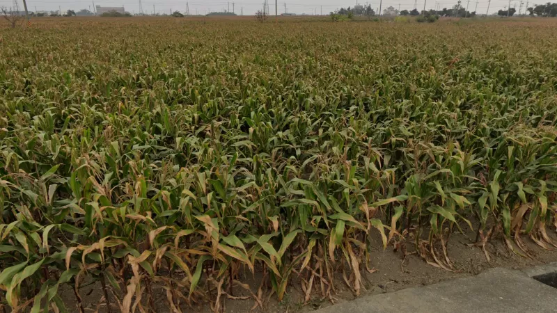
Cornfields are common in a specific area in the southwest of the great plain, encompassing western parts of Chiayi and Tainan counties as well as much of Yunlin.
As mentioned in the landscape section, large soybean fields are exclusive to Pingtung. However smaller fields are also helpful as they are heavily concentrated around northwest Chiayi and southwest Yunlin, especially in Liujiao (六腳) and Beigang (北港) townships.
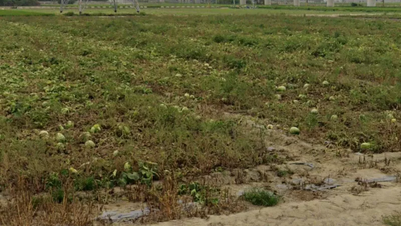
Watermelon is a very thirsty crop that tends to grow right by rivers, in areas that often don’t have roads. It can however sometimes be seen, especially between Tainan and Kaohsiung, where it tends to grow in more open fields, as well as towards the northern end of the Hualien Valley around Fenglin (鳳林) and Shoufeng (壽豐) townships.
Sweet apple (Annona squamosa) is a tree with very distinctive large, droopy, oval-shaped leaves that grow in dense rows on long branches. In Taiwan it is pretty much exclusive to Taitung, where it’s a pretty common sight.
Chrysanthemum flowers are grown in a very specific area in Changhua county covered by Tianwei (田尾) and Yongjing (永靖) townships. They grow in neat rows and while it is very rare to see them flowering, they are still identifiable by their knee-height vertical stalks with lobed parsley-like leaves.
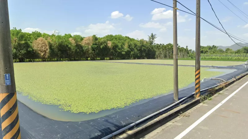
These man-made ponds with a layer of green algae floating on top are concentrated in Meinong district (美濃區), located in the part of Kaohsiung county north of Pingtung.
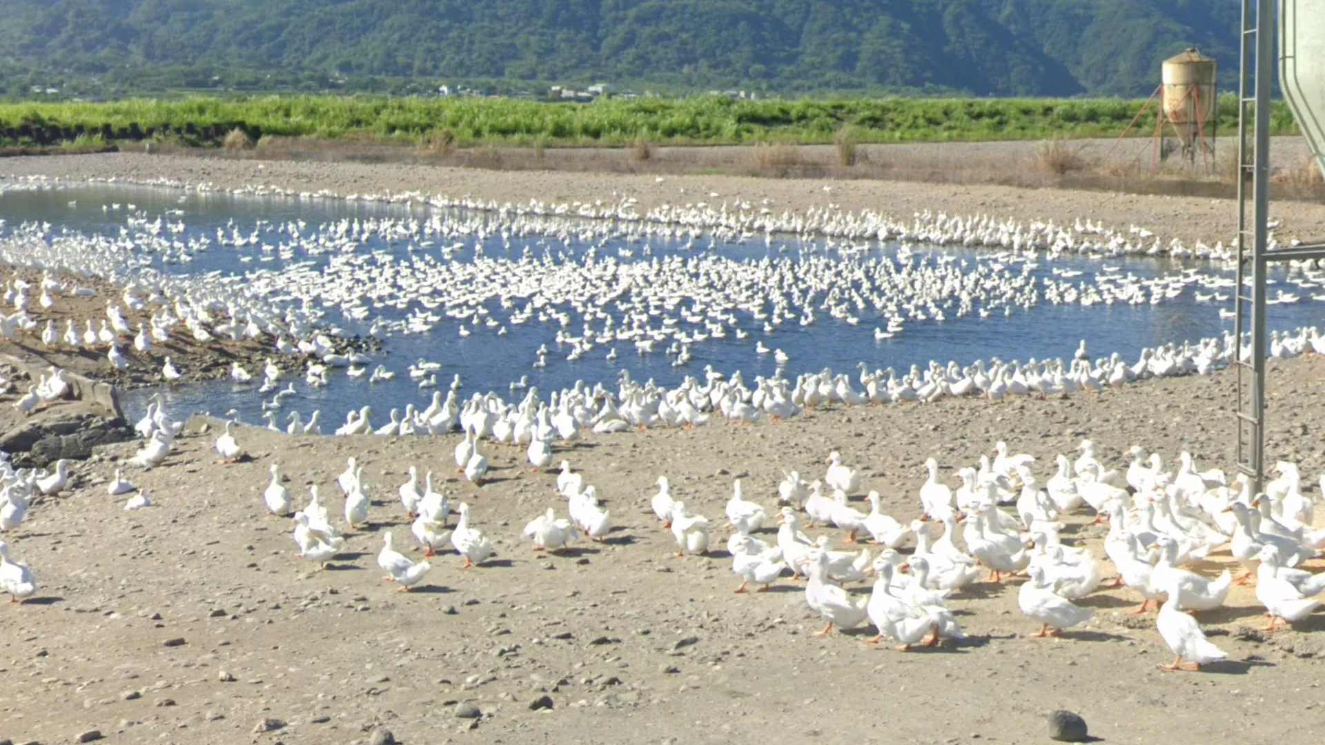
Roughly in the middle of the Hualien valley, in northern Yuli township (玉里鎮), you can find very unique water plots. Many of these serve as duck farms, with huge flocks of ducks visible.
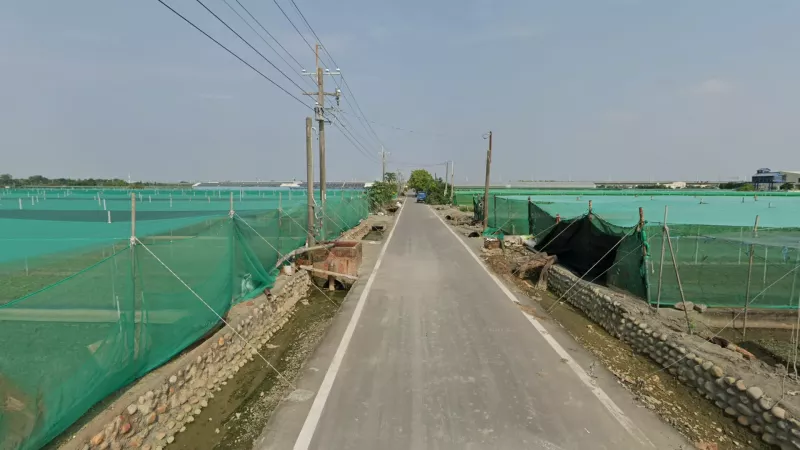
You can find large areas completely covered in turquoise netting in the north of Yunlin county, specifically around the town of Xiluo (西螺).
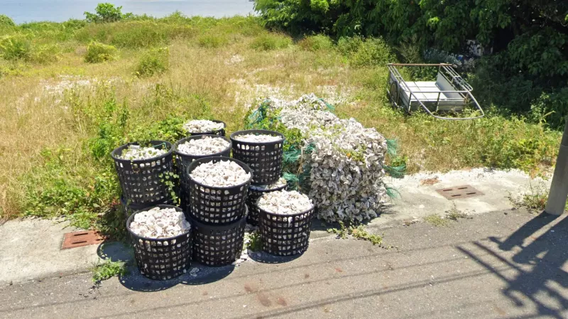
Most oysters in Taiwan are harvested along the coast of Chiayi county in Dongshi (東石) and Budai (布袋) townships. This is amply visible in towns and villages where baskets or piles of oyster shells can frequently be seen lying around. Empty baskets can also be an indicator. You can also find these further up the coast up until Fangyuan (芳苑) township in Changhua and further south down to Qigu (七股) district in Tainan.
Architecture
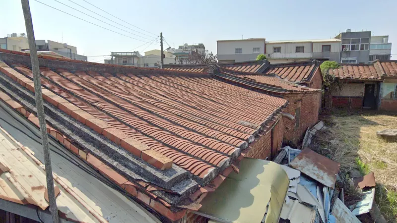
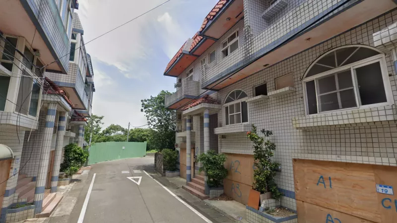
While traditional houses are often associated with Kinmen, they can be found abundantly on the main island too. Within the western plain, there is a north-south dividing line going through Chiayi county that distinguishes two main types of architecture. South of the line you can find traditional rounded orange tiles, like the ones seen on Kinmen. Note that this meta is purely intended for guessing within the western plain, the distribution of tiles in other areas is not particularly consistent.
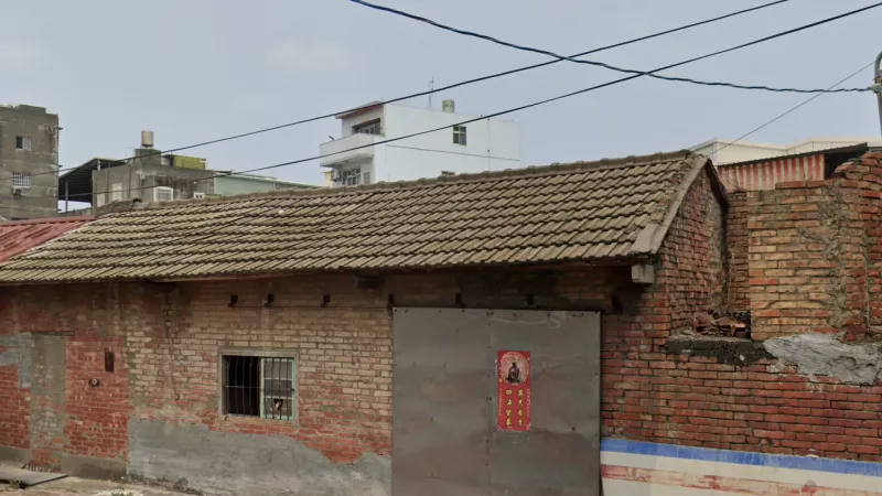
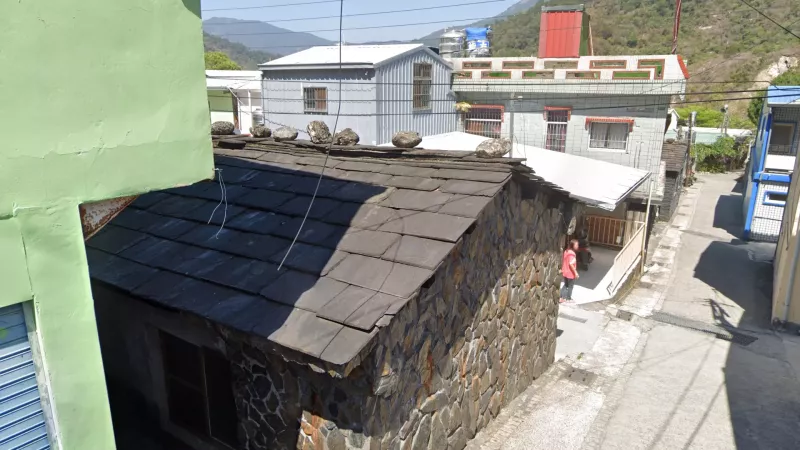
Within the western plain north of Chiayi, however, traditional houses generally feature flat black tiles.
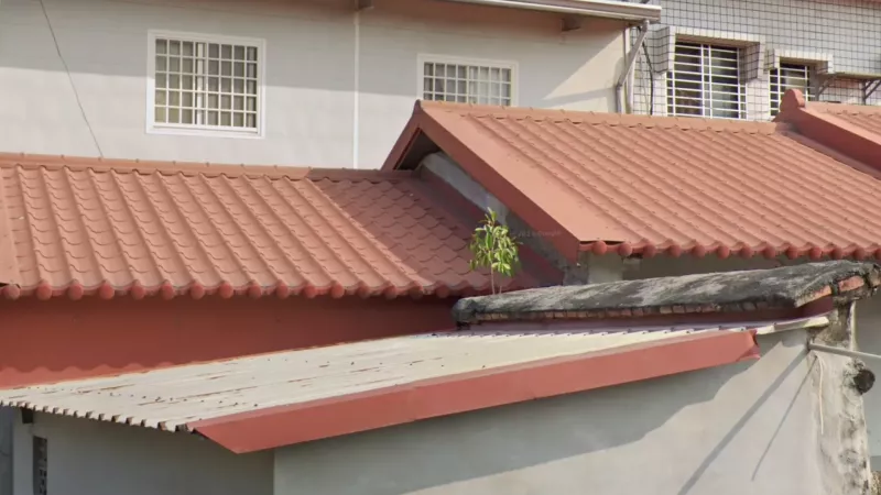
Small houses with roofs made of more modern red plastic tiles are very common in Tainan, Kaohsiung and Pingtung, although they can rarely be seen all the way up to Taoyuan.
Houses painted in this distinct polyurethane waterproof green paint are a common sight in Pingtung. Note that a similar colour can often be seen on larger buildings in Changhua; however, on smaller dwellings it is very much a feature of Pingtung.
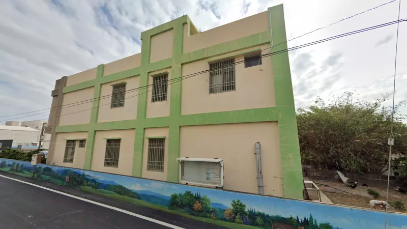
In northern Changhua county, you’ll see a lot of multistorey houses with large frames painted a different colour from the rest of the building (most often green).
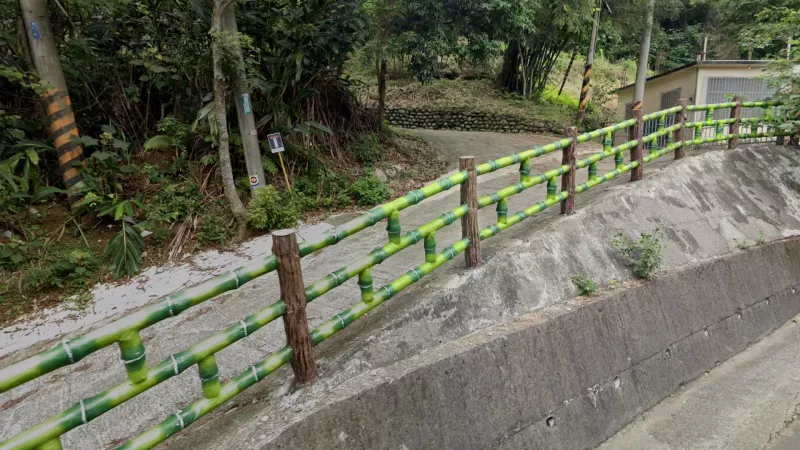
Fences painted to look like bamboo are more common in Taoyuan and the Taipei Metropolitan Area; however, they can rarely be seen in the rest of the country.
Slate is often used as a traditional building material by aboriginal groups in the far southern mountains of Taiwan, particularly in Rukai-populated areas in Wutai (霧臺) and Sandimen (三地門) townships.
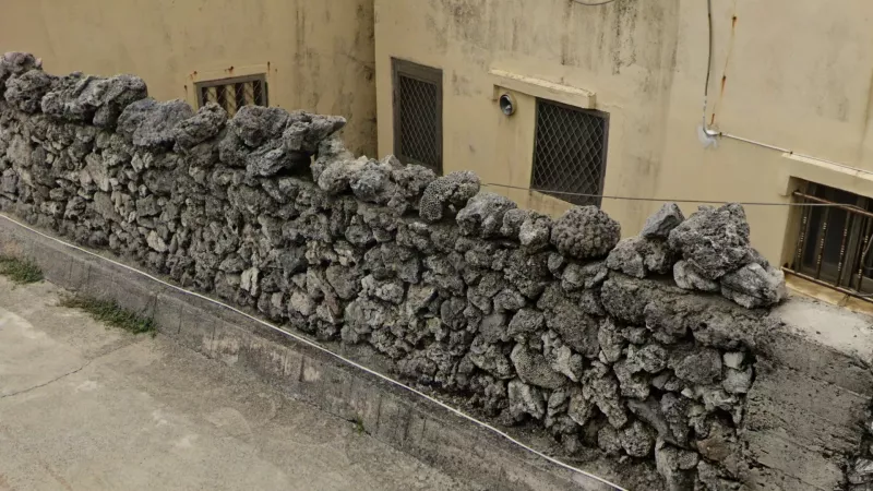
Coral walls are common on Bird Island (吉貝嶼) and can also sometimes be found in northern parts of the main Penghu islands.
These flat-topped rock walls are extremely common on Qimei island (七美嶼), the southernmost island of Penghu county.
On the Matsu Islands (馬祖列島), you can often find buildings made of large, beige rocks.
Infrastructure
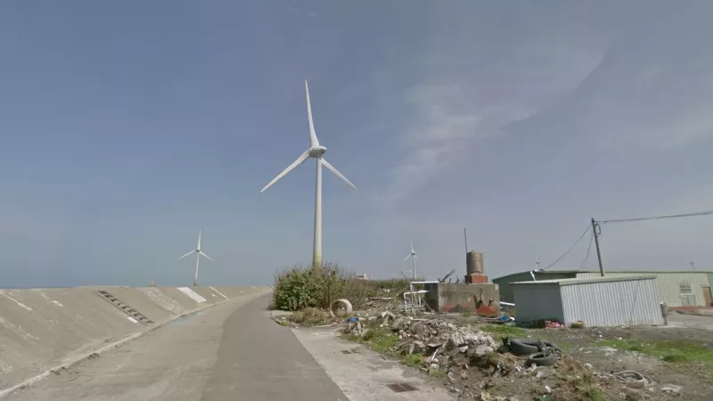
Wind farms are found all along the northwestern coast of the island, extending no further south than Yunlin county.
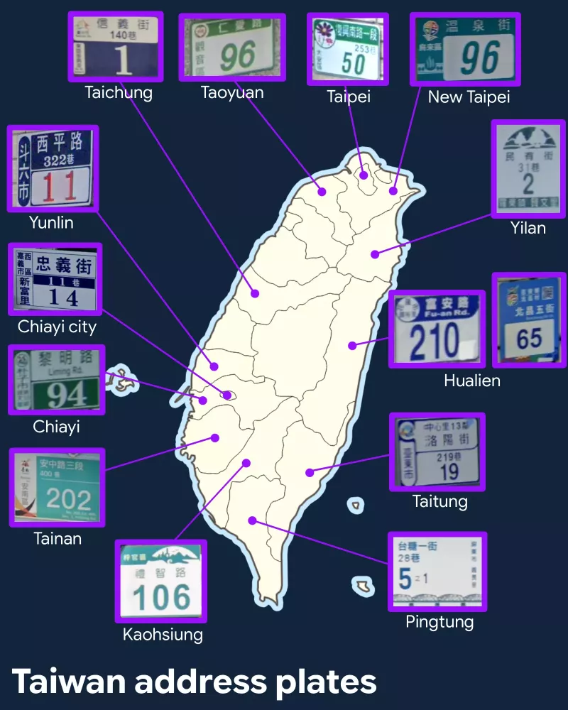
Beside the standard design, most counties and cities have their own house number plaques that are very useful for regionguessing. Counties that do not have a design indicated tend to use the standard nationwide design (see above).
* Taipei house number plates has a flower logo in the top-left corner
* New Taipei plates are a unique turquoise colour and have a yellow-red-blue-green logo
* Taoyuan plates have a heart logo in the corner, Taoyuan city uses green but colours change depending on district (for example dark purple in Yangmei)
* Yilan plates are more vertical and have a semi-circle with trees on it on the top
* Taichung plates are blue with white segments, with the county’s ‘pavillion’ logo in the corner
* Hualien plates have large numbers and a circular logo in the corner - blue is the standard colour in Hualien city, but other colours exist in the county (red is useful for Yuli, green for Fenglin, while Ji’an uses a completely separate skyblue vertical design)
* Yunlin plates have unique red numbers on a white segment, with blue segments on the sides
* Chiayi plates are green with white segments, and numbers in a ‘Parisian’ font
* Chiayi City plates are white with dark blue writing and a small strip in the middle
* Tainan plates are modern, bright green with a white strip on the left with fiery markings
* Kaohsiung plates have a green strip with a white semicircle logo along the top
* Pingtung plates have diverse colours and logos depending on the township, but are consistent in shape and placement and tend to feature an item that defines the area (examples from Ligang and Checheng)
* Taitung plates have white rounded segments with dark blue writing and a logo in the corner
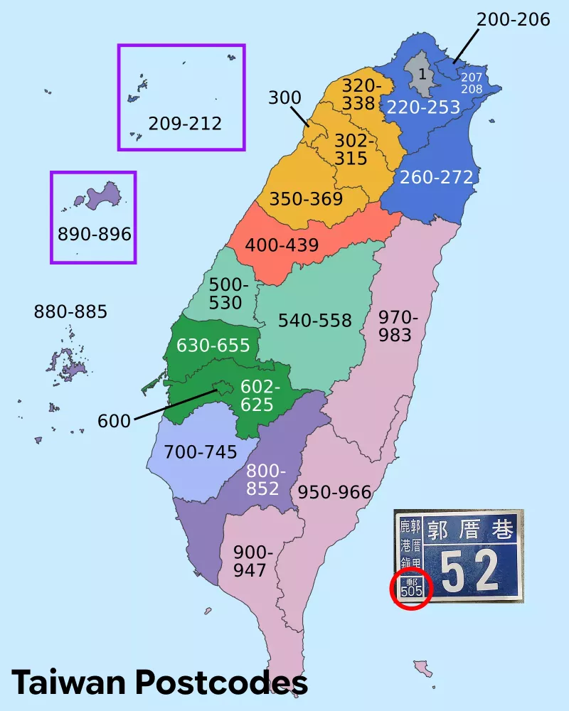
On the standardised nationwide design of house number plaques, there will be a 3-digit postal code in the bottom left corner which is very useful for regionguessing. In the example, 306 corresponds to Hsinchu county. You can also find the township written in the top left, in this case Guanxi (關西鎮). Note that while these standard plaques can be found throughout the country, they are far more common in counties that do not have a standard design of their own (see below).
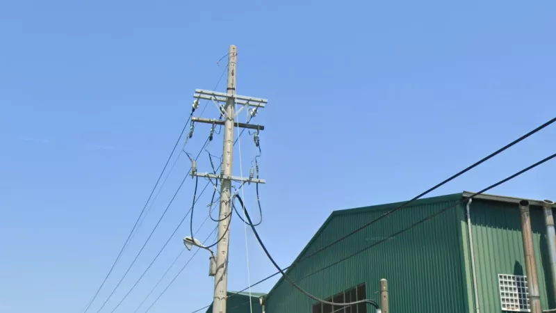
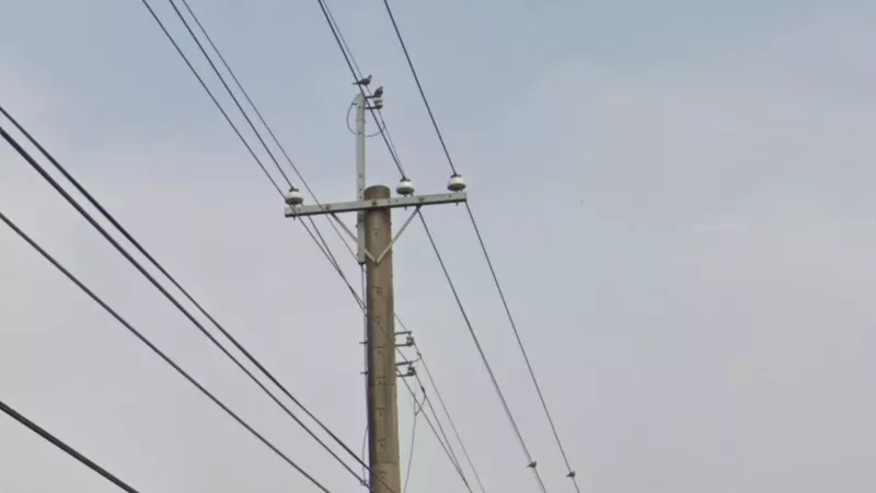
Poles that extend significantly higher above the crossbar than average are found in a number of disconnected counties, making them helpful to break certain 50/50s (for instance, Hsinchu vs. other northwestern counties).
Poletops featuring a long rod that, most importantly, extends below the diagonal support, are mostly found in Pingtung, although can also be found in the Annan district (安南區) of Tainan.
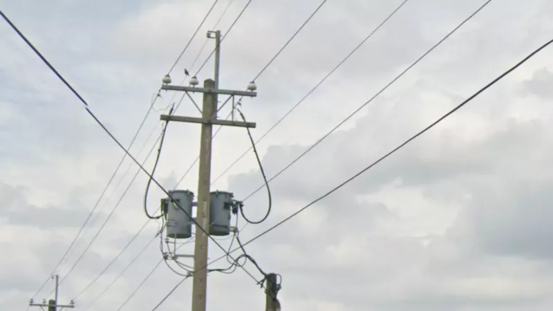
Twin diagonal supports with an extra vertical support creating a ‘VI’ shape between two horizontal bars are found commonly in Tainan and Kaohsiung, as well as more rarely in Pingtung and Hualien.
Diagonal support bars attached at a shallower angle (around 60°) under the extra top bar are exclusive to Taichung. Note this applies only to the top bar in situations where there is more than one horizontal bar - otherwise, shallow-angle attachments can be found everywhere.
In the eastern counties as well as Pingtung, you can find pole tops consisting of two vertical metal bars connected by thin horizontal wires.
Metal horizontal attachments at the very top of the pole can be found almost exclusively in Yunlin and Pingtung counties.
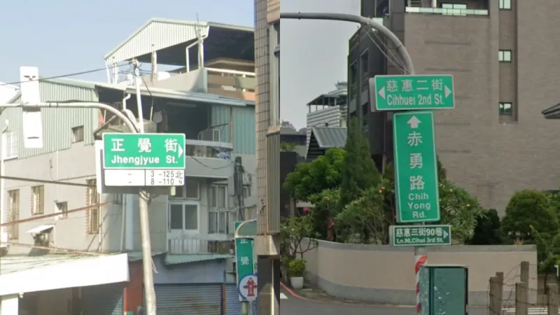
Signs for smaller streets are township-dependent, and many have unique recognisable designs.
* Luodong has off-green signs with a ‘square arrow’ on the end and an English transliteration in a fancy font
* Yilan has a pointed, three-striped (green-yellow-green) design with a cloud shaped attachment on the top. Other designs exist but all Yilan designs include a cloud attachment
* Jiaoxi has a crude pointed cloudy design and brown poles for their street signs
* Miaoli uses very unique designs with bulbed ends and Chinese characters in a fancy font. They can be both horizontal and vertical
* Houlong has a thin white strip with English in a thin font, and a subtle bump on the top.
* Puyan has brown signs and a floral logo on the top of the pole.
* Tainan sometimes has a plum blossom flower with a number on it on their signs.
* Chishang signs have a janky font and red arrows
* Luye has a bulb-tipped design with a metal bar on top (the bulb-tip is not fully unique, but other areas will not have it paired with the metal bar)
* Taimali signs are plastered on a larger white background and have a cartoon bird logo on top
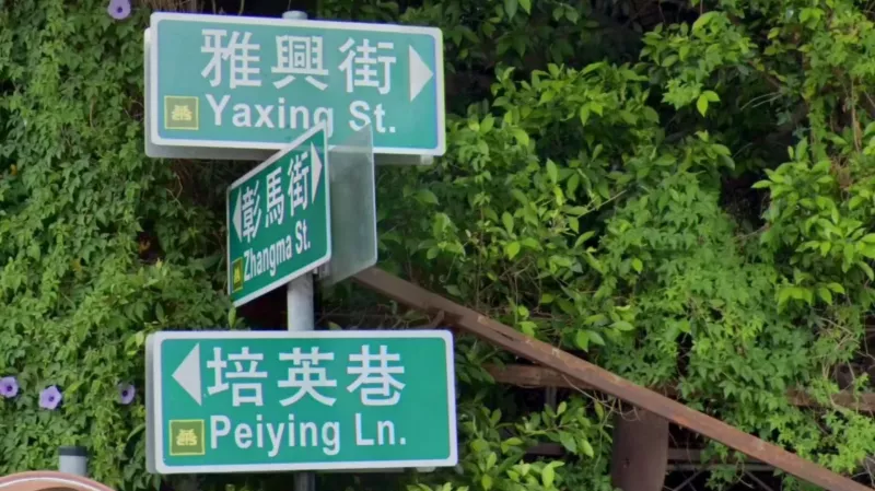
A lot of townships in Changhua county have a little sticker with the respective township’s logo on their street signs.
In Kaohsiung City and numerous surrounding districts, signs at large intersections use these unique large sectioned metal frames with signs and traffic lights embedded in them.
In the cities of Chiayi and Tainan, street signs have cardinal directions written in the bottom white section, consisting of a latin letter and a Chinese character.
Taitung City uses standard signs, but with the city logo on them, which features a sun and a river. This logo can occasionally be seen on house number plates too.
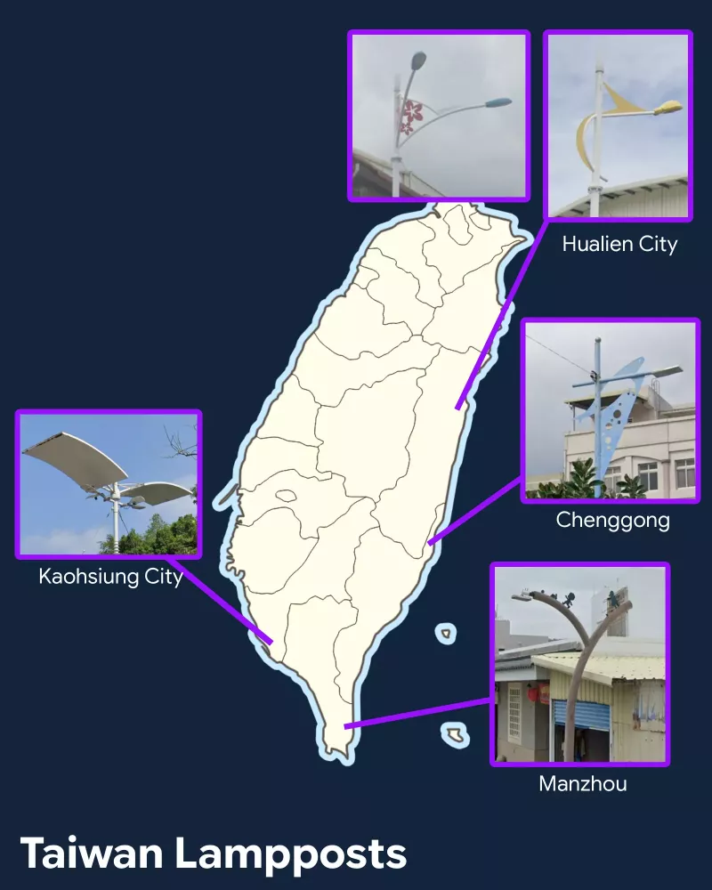
A lot of cities/townships in Taiwan use their own unique and quirky lamppost designs:
* Kaohsiung - in the downtown area you can often see lamps with large ‘elephant ear’ flaps over the lamphead
* Hualien - two notable designs found throughout the city; one with blue lampheads and red flowers (the ‘hua’ in Hualien means ‘flower’) and another with curved yellow attachments
* Chenggong - uses various sea animal motifs on its lampposts (note: bluefin tuna lampposts specifically can be found in Donggang township, Pingtung)
* Manzhou - uses short wooden lampposts, often with silhouettes on top
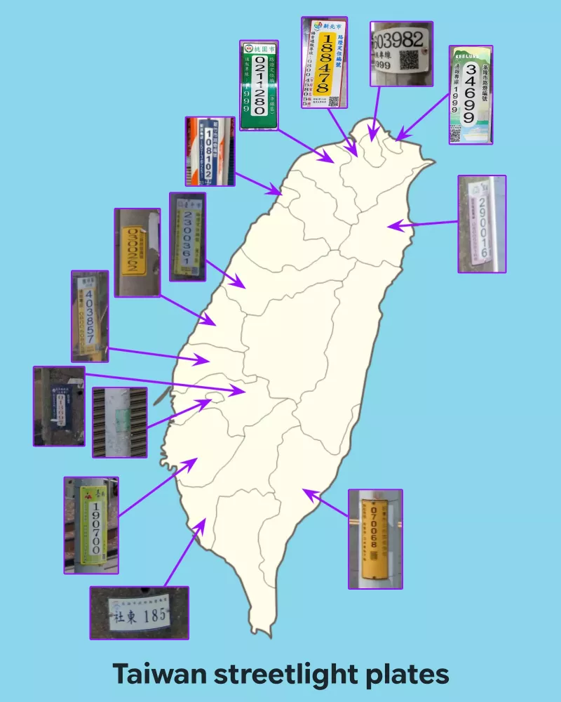
This map shows the different standardised pole plates used by different counties.
* Taipei - always includes a QR code
* New Taipei - yellow on white
* Keelung - soft colours with a boat and natural scenery
* Yilan - pink; less unique yellow design can be found in Zhuangwei & Dongshan townships
* Taoyuan - dark green
* Hsinchu City - blue
* Taichung - pale yellow
* Changhua - this plate is often found on the lamp’s electricity box, which is unique
* Yunlin - yellow
* Chiayi - blue with red numbers, smaller than average
* Chiayi City - small, square, green plaque
* Tainan - lime green; rarely dark green similar to Taoyuan
* Kaohsiung - only county to use horizontal plates, similar to Taipei but less crowded
* Taitung - all yellow, slimmer than Changhua
There are several styles of traffic lights in Taiwan that usually correlate closely with certain counties/cities. These are the most important designs to remember, although note that there are often exceptions, making traffic lights a riskier meta in Taiwan:
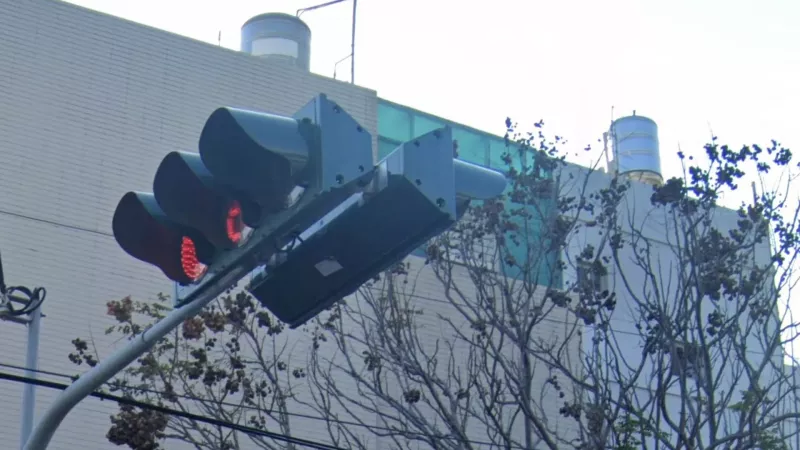
Most traffic lights in Taiwan have a visor that goes most of the way around the light, the two exceptions being Taichung and Hsinchu traffic lights. In Taichung, the cover is rounded inwards, like the head of a beluga whale. (These can occasionally be found in New Taipei as well)
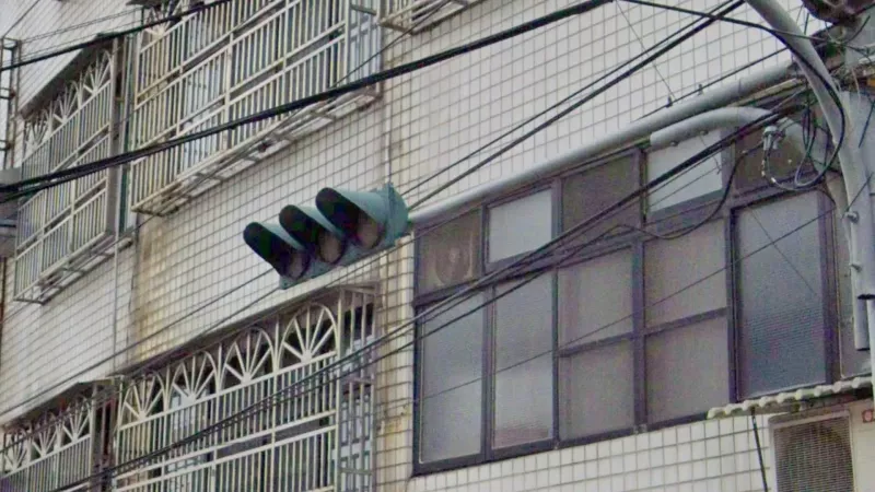
In Hsinchu, traffic light visors are pointier, like the head of a shark.
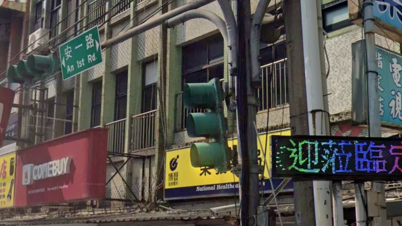
In Taipei, Keelung and Taoyuan, as well as less uniformly in Yilan and Nantou counties, visors go most of the way around the light, and have a more saturated green colour (all other regions have duller shades of green or grey).
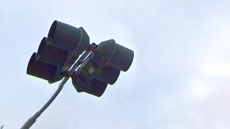
In most southern counties/cities, but also in Miaoli and New Taipei, traffic light visors go all the way around the light.
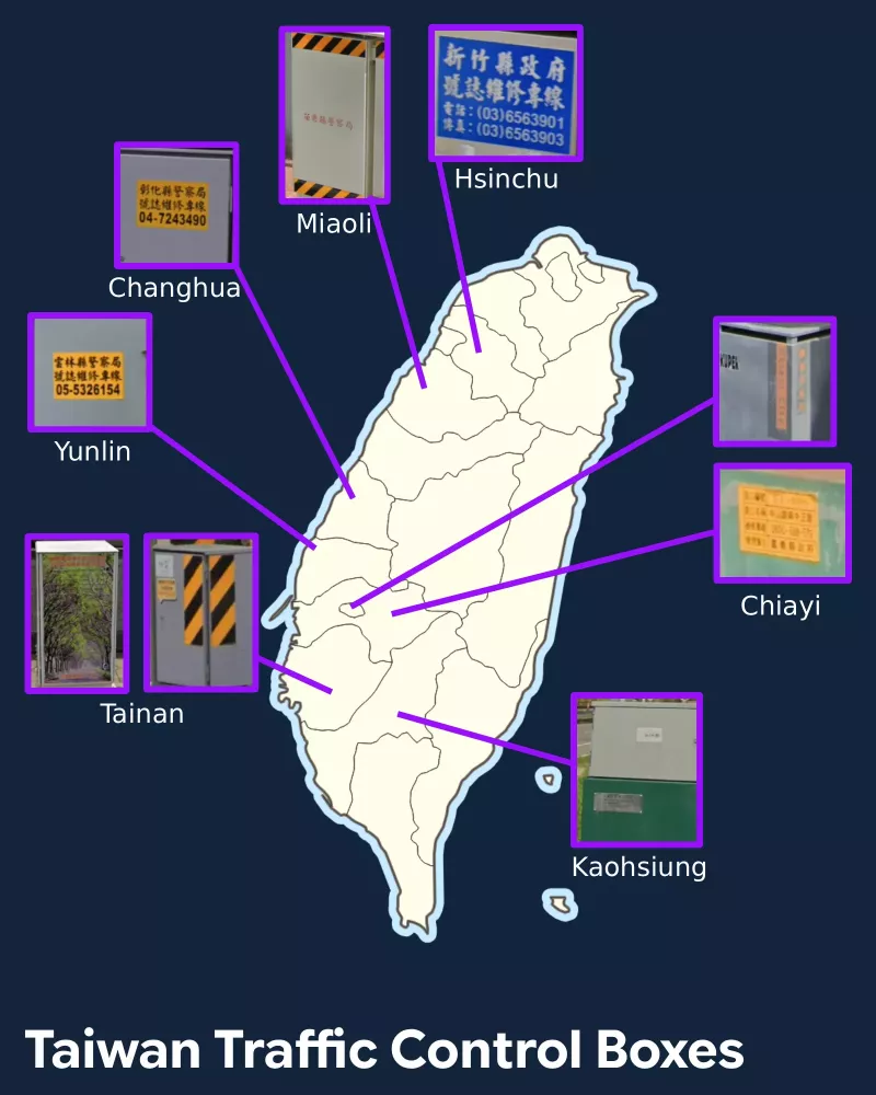
Traffic lights in Taiwan typically have an electricity box next to them, and these often have stickers or designs that are county-dependent. Note that many of these have the county name in Chinese characters, however these can be hard to read in certain circumstances.
* Hsinchu uses a large blue sticker with white writing
* Miaoli has a small line of red writing on its traffic control boxes
* Changhua has a large yellow sticker with two lines and a number starting with ‘04-’
* Yunlin has the same as Changhua, but with a number starting with ‘05-’
* Chiayi uses a small yellow plaque with four lines of text
* Chiayi City has orange vertical lines of text on two sides (one of which reads ‘Chiayi City’ in English)
* Tainan has two designs - one with a large black-yellow stripe sticker in the corners, one with a large poster featuring a road lined by trees (note that the stripe stickers can also be found in eastern counties, incl. Taitung, however those typically cover the entirety of the box)
* Kaohsiung sometimes uses small grey tags on traffic control boxes
This single orange stripe with black edges can be found on the bases of transformer boxes in Hsinchu (both city and county). Note that this design is increasingly being introduced by other counties, so use this meta cautiously.
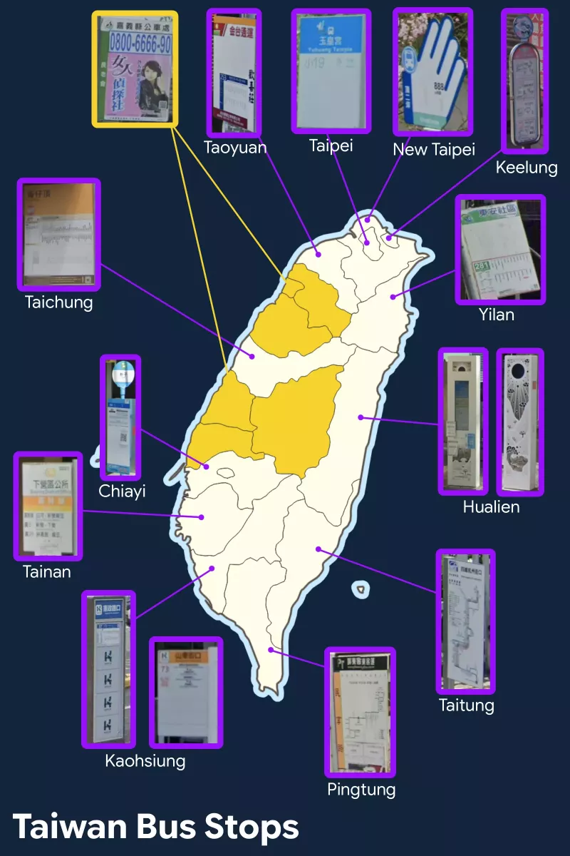
Bus networks are county-based, and therefore most counties have their own standard designs.
* Taipei uses modern, minimalist signs with a sky blue top section
* New Taipei has the most distinct design, with a large waving hand shape
* Keelung has an elongated sign in a metal frame, with an additional circular attachment on top
* The most common bus stop design consists of a simple, large placard with thin strips along the top and parallel to the pole. One side will have bus information while the other always has an ad. It is found in the counties marked yellow on the map.
* Taoyuan uses the same standard design described above, but consistently has an orange top strip and a red logo just below
* Pingtung also uses the standard design, but with a black top strip with the abbreviation ‘PT’
* Taichung has a much thicker orange top strip, as well as a brown strip along the bottom
* Yilan has a simple design with a top strip showing a green hill and cloudy skies
* Hualien uses a very unique futuristic-robot-looking design. These are always white with patterns featuring natural scenery, and a black circle/semicircle on top.
* Chiayi uses a very blue design, combining an elongated information plaque with a circular attachment above
* Tainan uses a simple design with coloured strips through the middle, usually orange or red
* Kaohsiung uses a few different designs, but the ‘K’ logo makes them very easy to identify
* Taitung uses all-white plaques that are conspicuously low to the ground
Chevrons in Taiwan often have a vertical line of three characters with a number on top in one of the corners. When you see chevrons with ONLY a number, you are likely in the centre-west of the country, in Miaoli, Nantou, Taichung, and rarely Changhua counties.
Signbacks attached to the pole via a long, flap-like attachment (creating an ‘L’ shape) are mostly found in Kaohsiung, but leak into neighbouring parts of Pingtung and Tainan.
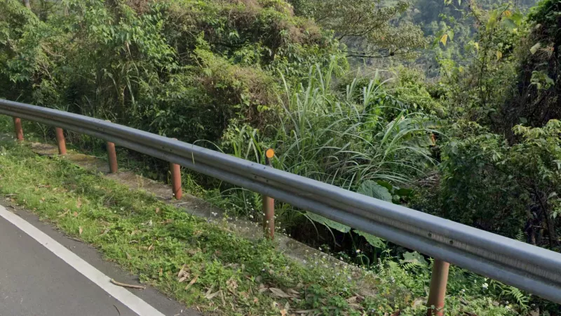
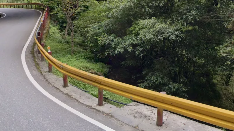
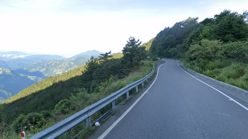
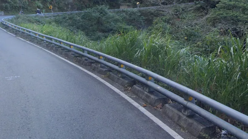
This type of guardrail composed of two metal beams and with reflectors placed on the supports is generally only found in the south and east of the country.
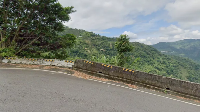
Exclusively in Chiayi you will sometimes see variants of the typical yellow horizontal guardrail reflectors with black stripes.
Guardrails with red supports are exclusive to Hsinchu county as well as one mountain road in Yilan. Note that they can often appear faded, making them harder to identify.
While red outer lines can be found all over Taiwan, red-painted curbs are unique to Taipei city.
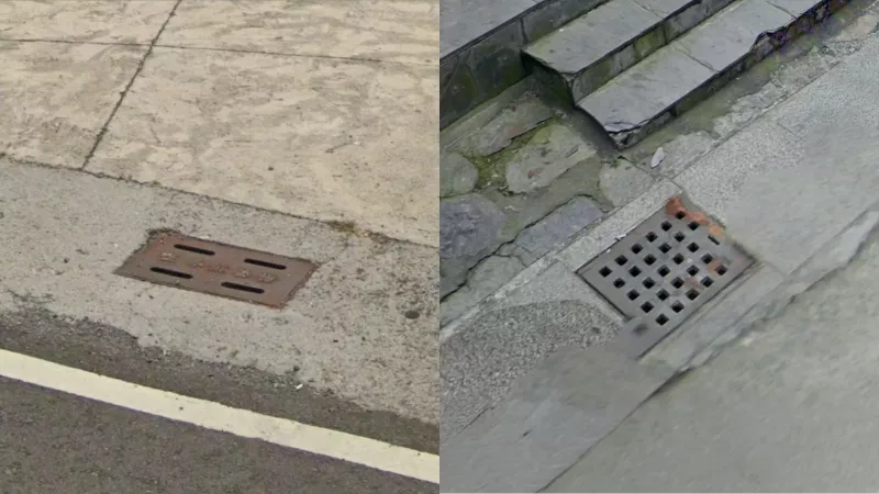
Storm drains are very common on Taiwanese roadsides. The following two designs are exclusive to the south of the country - square holes with wide grids in between; four long holes on a rectangular drain. This is in contrast to newer, slicker designs with thin grids which can be found all over the country.
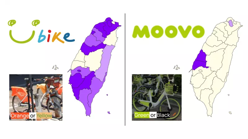
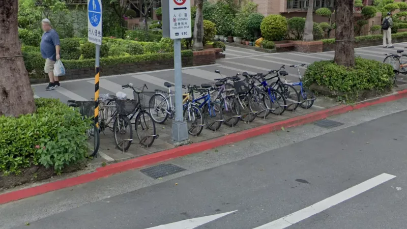
Bike sharing stations are a common sight in Taiwanese cities. The most common is YouBike (orange bikes), found in most counties, however MOOVO (lime green bikes) is limited to Changhua and Yunlin counties.
Changhua city wraps nets around the bottom of poles to prevent advertising.
Taoyuan International Airport (Taiwan’s largest airport) is planned to be expanded. As a result, in the immediate vicinity of the airport you’ll find a large number of boarded up abandoned houses.
Culture & Linguistics
Chinese
Street signs in Taiwan always have a Latin transliteration. However there are two competing systems of transliterating Mandarin that are used on Taiwan: Hanyu pinyin and Tongyong pinyin. Hanyu is found everywhere, but Tongyong is much more common in the southwest, and extremely rare in the north and some other counties. In Tainan and Kaohsiung, almost all signs use Tongyong.
Typical Tongyong letter combinations not found in Hanyu include ‘jh’, ‘jy’, ‘sy’, ‘cy’, ‘ih’, ‘iou’, ‘uei’, ‘siao’, ‘wun’ and ‘chung’. This table compares the Pinyin and Tongyong transliterations of all syllables.
Typical Tongyong letter combinations not found in Hanyu include ‘jh’, ‘jy’, ‘sy’, ‘cy’, ‘ih’, ‘iou’, ‘uei’, ‘siao’, ‘wun’ and ‘chung’. This table compares the Pinyin and Tongyong transliterations of all syllables.
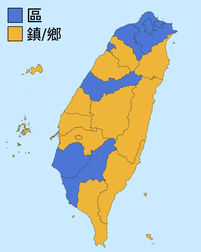
There are three types of second-order division in Taiwan, 區 (qu) or ‘districts’, 鎮 (zhen) and 鄉 (xiang), urban and rural townships respectively. Some counties only use 區, while the rest use a mix of 鎮 and 鄉. If you see a place name with these characters you can therefore rule out a decent number of counties.
The Han Chinese population of Taiwan can mostly be divided into Hakka speakers and Hokkien speakers (with a later migration of Mandarin speakers). The Hakka minority are concentrated in Taoyuan, Hsinchu and Miaoli counties, with smaller pockets in the south.
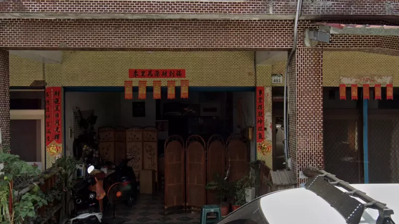
The main clues that you may be in a Hakka area lie in the red character strips (Fai Chun) posted around front doors. In Hakka areas, you will often see five hanging ‘福’ strips above the door, and sometimes the large top strip will feature a 3-character ‘hall name’ with the character 堂 (on the left in Northern Hakka areas and in the middle in Southern Hakka areas).
Furthermore, Hakka place names sometimes end in the characters 窩 or 屋, which are not used in other regions (this is only for the smallest settlements, but they can still appear on some direction signs).
Aboriginals
Most mountainous areas of Taiwan are home to aboriginal, Austronesian ethnic groups. If you see colourful patterns featuring lots of triangular or diamond shapes and murals depicting nature or traditional practices, you are likely in an aboriginal area. You can even rarely see signs in aboriginal languages. Different patterns are used by different groups, so these can be useful in regionguessing. Highlighted below are the most important patterns, however you can find more detail in this document.
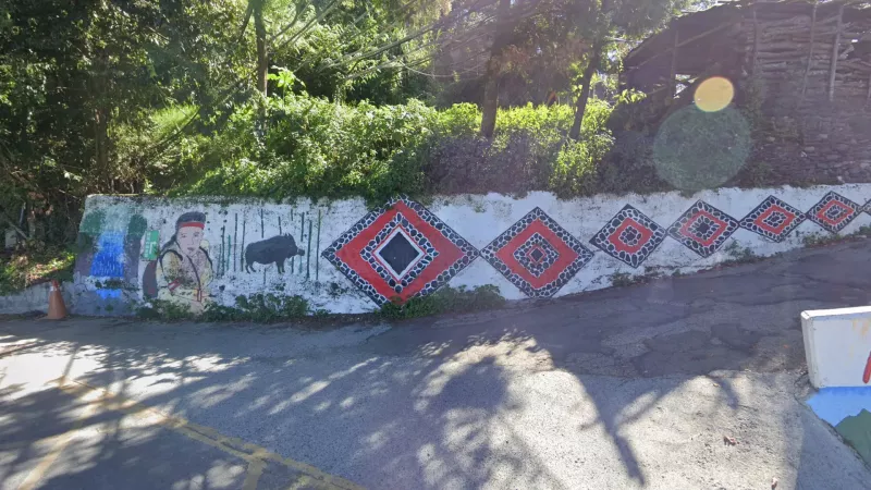
The Atayal (泰雅) tribe use a ‘diamond-within-a-diamond’ motif very often, usually in a red-white-black colour scheme, something only rarely seen in other areas. They inhabit the northern mountains, and are most heavily concentrated in northern Nantou county.
The Tsou (鄒) use a pattern of alternating black, red and blue triangles in a band. This is a good one to learn as it is both unique and very commonly used in Tsou areas in far-western Chiayi.
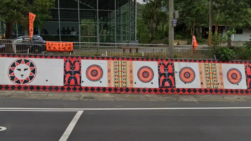
Inhabiting the mountainous parts of Pingtung and southern Taitung, the Paiwan (排灣) and Rukai (魯凱) have quite similar art, very often featuring depictions of traditional pots, and the double-snake motif, not found among other tribes. You’ll also find anthropomorphic depictions which are reminiscent of African art, and a motif that looks like a lion’s face inside a sun.
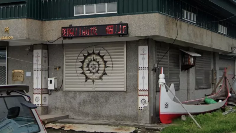
The Yami (雅美) (or Tao 達悟) are the native people of Orchid (蘭嶼) and Green (綠島) Islands to the southeast of the main island. Here you will often see the native 8-pointed sun motif and depictions of traditional boats, all in a red-white-black colour scheme. (Note: you are far more likely to see these on Orchid island than Green island).
Food
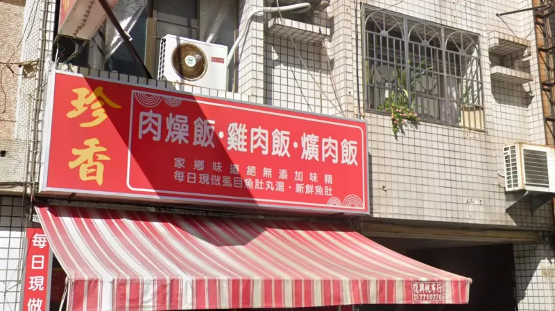
One of the most well-known Taiwanese dishes, Lo-bah-png (滷肉飯 or ‘minced pork rice’) is referred to instead as Bah-so-png in southern Taiwan - 肉臊飯. If you see these characters on restaurant signs you are almost certainly in the south of the country. Meanwhile the similar chicken rice dish 雞肉飯 is indicative of Chiayi city, although that can be less reliable.
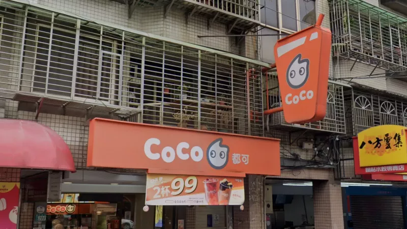
CoCo (都可) is a famous bubble tea shop in Taiwan. They are mostly found in northern Taiwan. They can also be found in central Taiwan, but are less common.
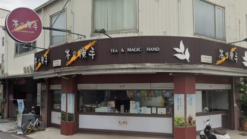
Tea & Magic Hand (茶の魔手) is another famous bubble tea shop in Taiwan. They are mostly found in southern Taiwan, especially in Tainan City and Kaohsiung CIty. They can also be found in central Taiwan, but are less common.
Recognisable Roads
Provincial Highway 8 going through Taroko National Park (太魯閣國家公園) often features yellow guardrails with red supports. These continue for a short stretch onto Route 14.
Provincial Highway 14 is the northernmost of the two highways crossing over the central mountain range. Most of the route from Ren’ai (仁愛) until it merges with Route 8 follows the top of a mountain ridge. Due to the altitude, the surrounding vegetation will consist mostly of conifers.
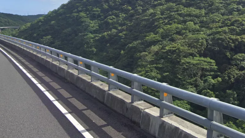
Provincial Highway 20 is the southernmost road connecting the east and west of the country. You can tell it apart from the others by the presence of reflectors on the underside of the guardrail.
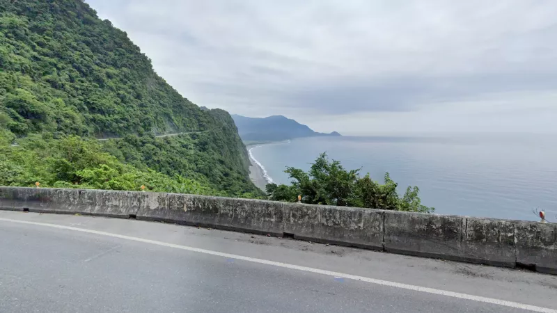
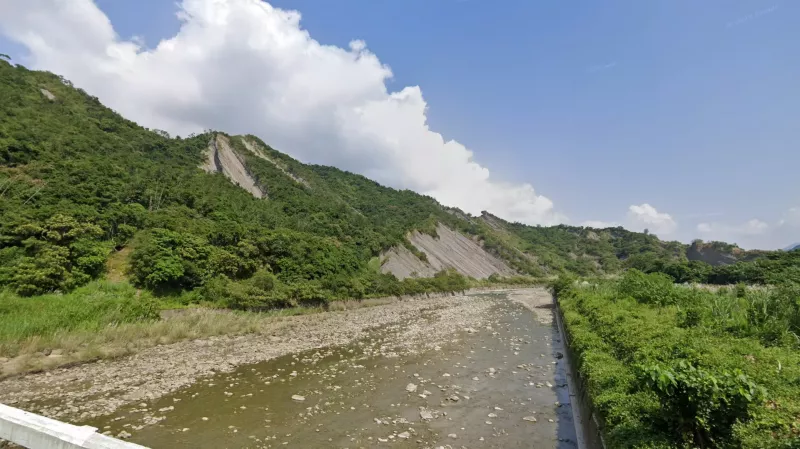
Provincial Highway 9丁 is extremely recognisable - this coastal area between the Yilan and Hualien plains is the only section of the east coast where tall mountains (>1000m) directly border the ocean, resulting in impressive cliff scenery with no flat space on either side of the road. Because of the extreme steepness of the mountains towards the southern end of this stretch, exposed streaks are visible on the mountainsides as the result of landslides. This can also be a good way of identifying the northern end of the Hualien plain.