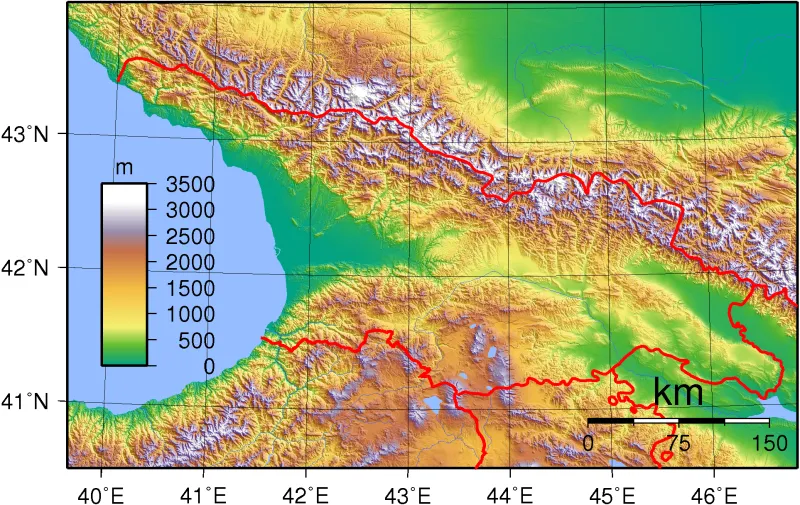
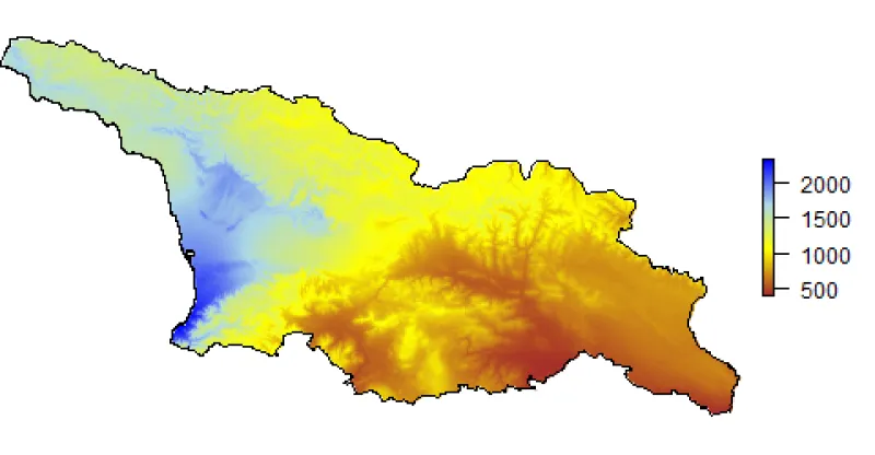
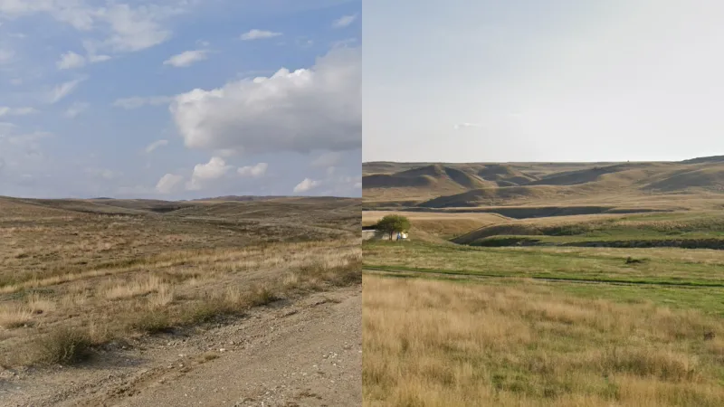
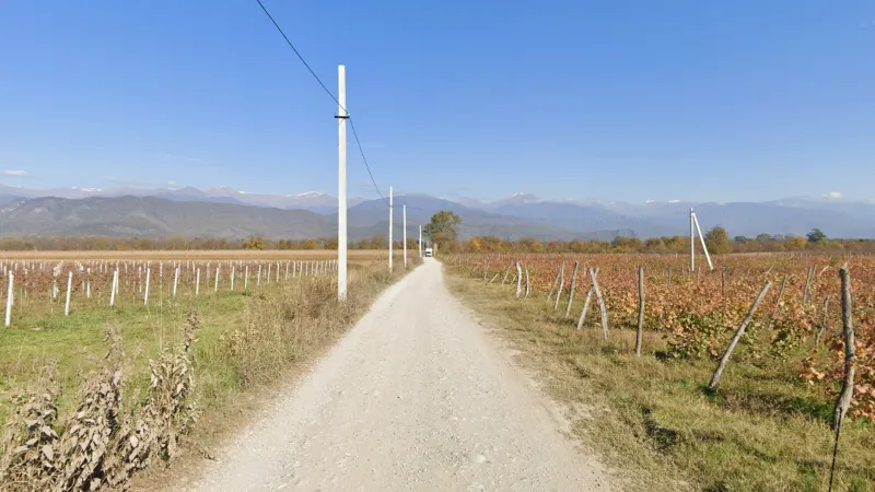
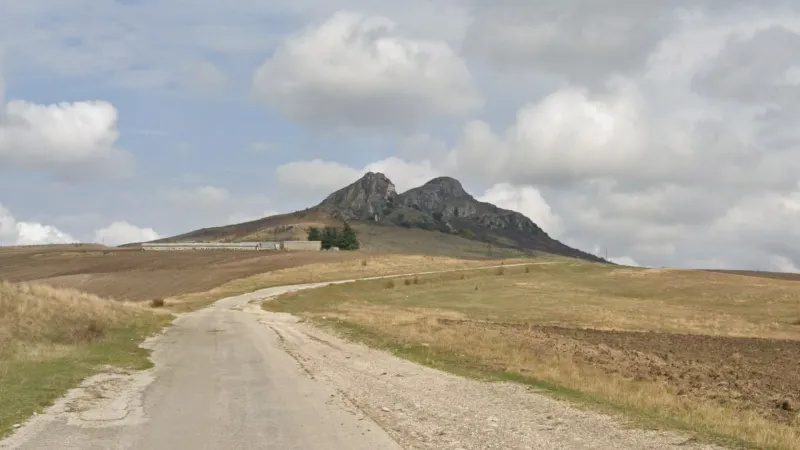
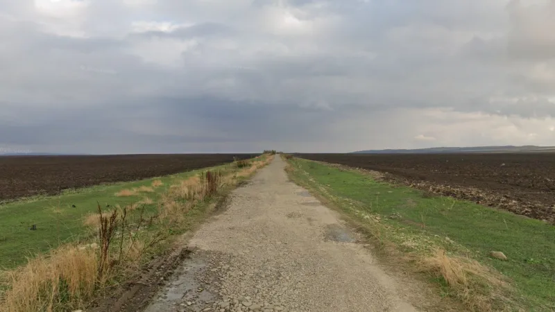
Georgia has a very interesting and complex topography. There are two large mountain ranges, the Greater Caucasus in the north and the Lesser Caucasus in the south. Between these are two flat river valleys. In the west is the Rioni valley and, in the east, the valley of the Kura and its main tributary, the Alazani. Combined with the stark humidity difference between east and west (see below), this makes Georgia a very regionguessable country using landscape alone.
Humidity
There is a very stark difference in rainfall between the western and eastern halves of the country, with the coastal west receiving five times the precipitation that the arid southeast does. This means that the forests in the west are generally taller, denser and lusher than those in the east. You also see tree species that like wetter conditions (such as spruce, Japanese cedar, hazelnut and walnut) more in the west. Forests in the east will have shorter trees and be composed of hardier species such as oak.
Area Codes
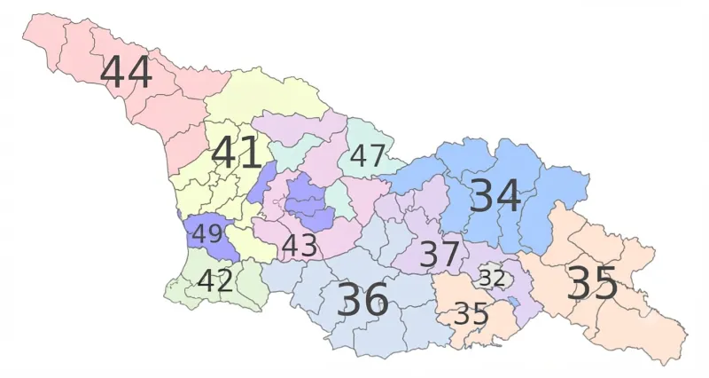
This is a map of Georgia area codes. Notably, area codes starting with 4 are in the west and those starting with 3 in the east. Telephone numbers starting with other digits are not regional.
Landscape
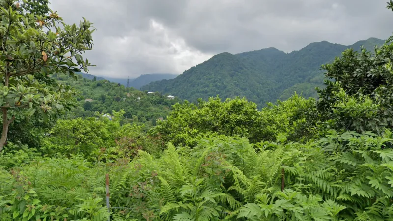
Due to warm ocean currents from the Black Sea, the Georgian coast is both very warm and very humid, resulting in a temperate rainforest climate, particularly in the mountains near Batumi where rainfall is highest. Here you will find very dense vegetation, with lots of ferns, vines, rhododendrons, butterbur, moss, palms and large-leaved deciduous trees such as alder.
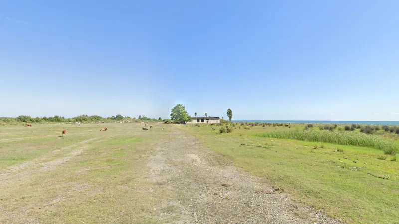
A very flat coastal plain reaches from the central portion of the coast up to the city of Kutaisi. This is the largest completely flat part of the country, and can be distinguished from flat areas in the east by the warm, humid climate. There are no tall mountains visible. Other common features in this area include cattle, flimsy wood fences, poplar trees and grassy dirt roads.
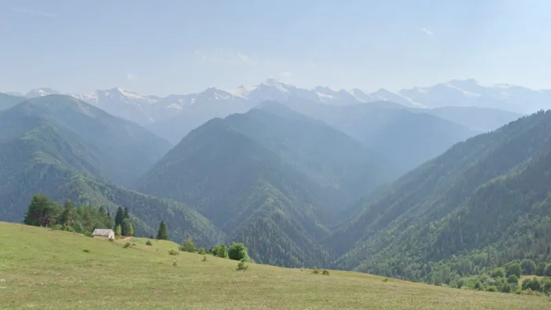
Svaneti is a cultural-geographic region in the northwest of Georgia that is fully within the Caucasus Mountains. Tall, snow-capped mountains, mostly (but not always) organised in east-west ridges, are almost always visible. However, the region can be more reliably told apart from the eastern Caucasus mountains by its much more forested environment.
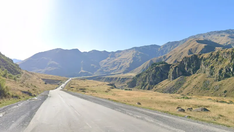
Kazbegi is the other high mountain area in the Georgian Caucasus that has coverage. The iconic Georgian Military Road, connecting the country to Russia, cuts through the mountains here. As mentioned above, it can be differentiated from Svaneti by the absence of forests along most of its length, although it is possible to find forests along the southern part of the road. However, even here, the trees are typically shorter and less dense than those in Svaneti.
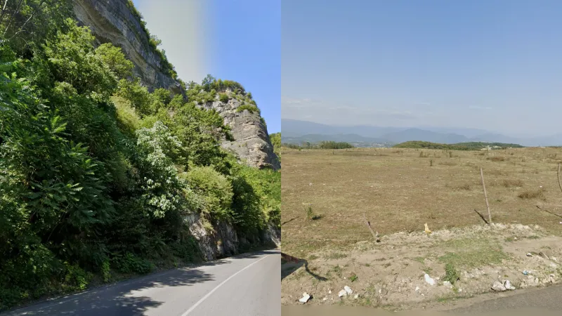
Chiatura is a famous spa town situated in a valley in Imereti. The valley itself is notable for its many exposed rock formations, while the plateaus above are recognisable for their patches of uncharacteristically barren land for western Georgia. This can create baity rounds that look eastern. However, you will generally see more cattle, flimsy fences and distant forests as well as architecture metas associated with the west in this area.Random piles of jagged rocks by the roadside are also common on the plateaus. Note the city itself is one of the rare instances where you can find commieblocks in a hilly setting.
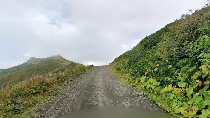
The Meskheti mountain range is located in the southwest of the country. Due to its high altitude, it creates a treeless but still humid island within the rainy and otherwise densely forested part of the country. There is only one road that completely bisects it: the SH14 crossing over the Zekari Pass.
Roughly in the middle of the country, south of South Ossetia and north of Gori, there is a large dead-flat area around the banks of the Liakhvi River. This area is identifiable by being the only flat region encased by low mountains to the north and south (unlike the Alazani valley with its much taller mountains to the north). Fruit trees are common in this area but not fully exclusive to it. Note there are some similar-looking flat areas further east around the towns of Saguramo or Sakdrioni. However these are much smaller and the mountains will always appear much closer.
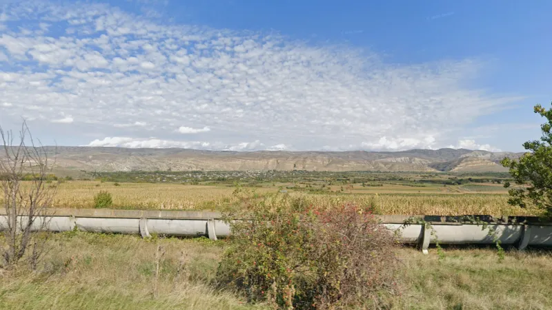
A dry ridge with clearly visible tilted rock strata can be seen to the north of the valley between Gori and Kaspi in Shida Kartli.
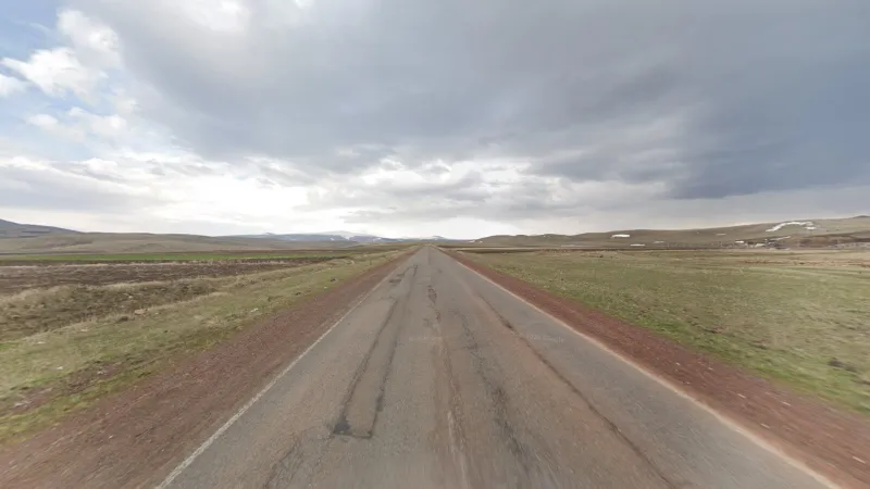
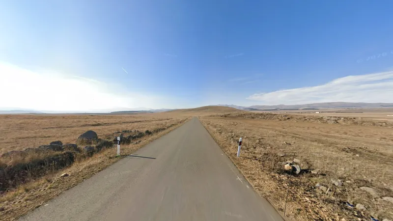
This part of Samtskhe-Javakheti consists of a barren plateau surrounded by volcanic hills. Isolated clusters of coniferous trees are sometimes visible in the distance. The road shoulders here are made from pinkish gravel and agricultural fields with dark soil can often be seen nearby.
Similar to the volcanic plateau of Samtskhe-Javakheti, this area near Tsalka has a hilly, steppe-like landscape with large clusters of coniferous trees visible in the distance. It can be distinguished by the absence of pinkish gravel road shoulders and by the comparative lack of agriculture.
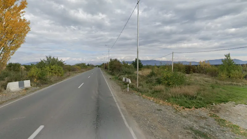
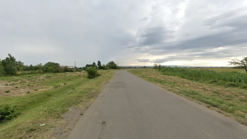
The area shown on the map, in the southeast of the country, has a relatively flat, dry landscape. This area is surrounded on multiple sides by low, dry ridges, which can sometimes be seen in the distance, and a taller dry ridge can be seen to the south in areas nearer the Armenian and Azeri borders. Business parks and industrial buildings can commonly be seen in this area.
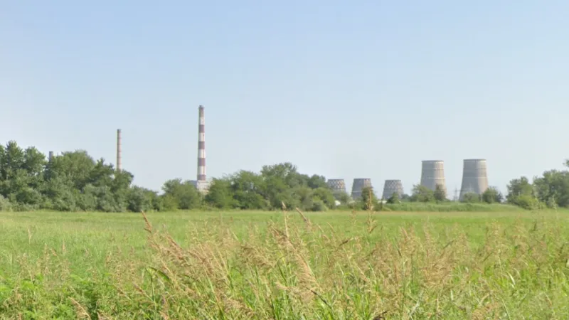
The Rustavi-Gardabani corridor in eastern Kvemo Kartli is the most heavily industrialised part of Georgia, with a chief characteristic being large industrial chimneys, often visible from a distance.
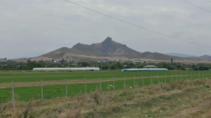
A distinctive rock formation overlooks the town of Shulaveri in Kvemo Kartli and can often be seen from the valley to its east.
The southeast of Georgia along the Azeri border is the driest part of the country. This semi-desert environment generally has undulating hills and no vegetation besides grass.
The Alazani Valley is a flat, wide, east-west valley located on the far eastern side of the country. The Greater Caucasus Mountains rise directly above the northern side of this valley, with snow-capped mountains often visible. A huge proportion of the valley is occupied by vineyards, which are relatively rare in other parts of the country.
These distinctive hills with exposed grey rock can sometimes be seen near the town of Dedoplistskaro.
The Shiraki Plain is an extremely flat agricultural plateau, with dark soil and an otherwise barren look.
Vegetation
Eucalyptus trees are exclusively found in the far west coastal areas of the country.
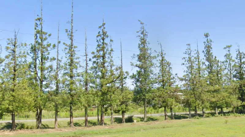
Japanese Red Cedar (Cryptomeria japonica) is a common tree in the humid far west of the country, being especially common in coastal areas.
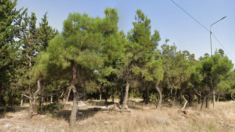
Forests of Turkish pines are exclusively found in the hills in the immediate vicinity of Tbilisi.
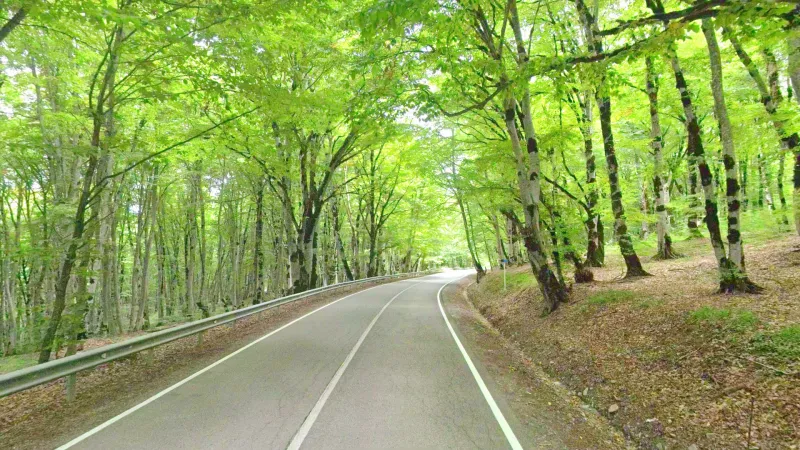
There is a unique beech forest in Tbilisi National Park, known as the Sabaduri Forest (clearly labelled on Google Maps), which looks unlike anything else in Georgia. Note that the trees are covered in heavy moss which can make them look like birch trees at first glance.
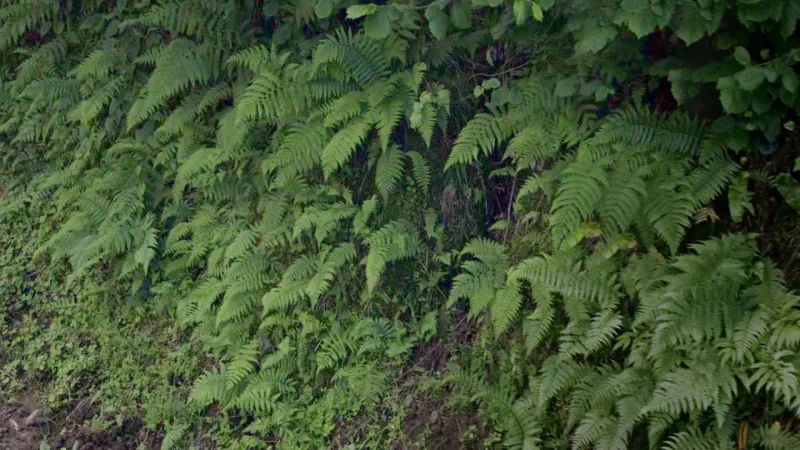
Ferns are a reliable indicator for the humid western half of the country, with particularly large quantities being a good indicator for the temperate rainforests in Adjara and near the Abkhaz border.
Architecture
Wall Features
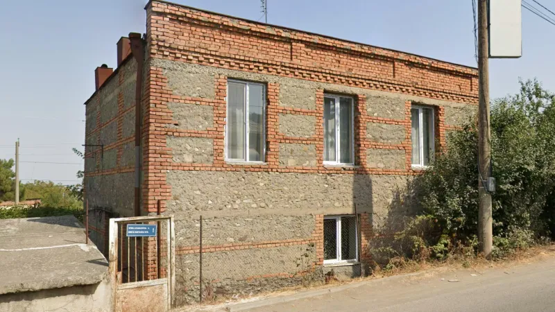
Buildings with exposed red brick accents, which may frame windows, form grids or run horizontally through walls, are found primarily in Kakheti.
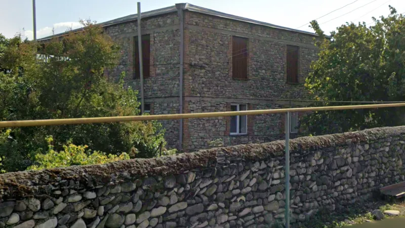
Walls made from small rounded rocks are most commonly found in Kakheti.
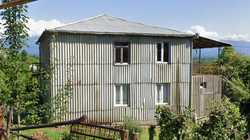
Residential buildings with walls covered fully or partially with corrugated metal sheets can sometimes be found in the west of the country. They are especially common in the coastal areas south of the Rioni River.
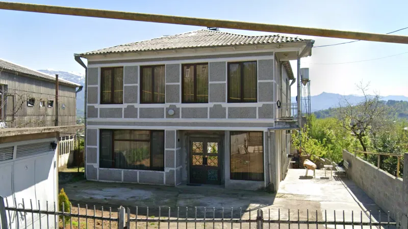
Although not as common as the buildings with corrugated sheet walls, buildings with walls made from rectangular panels with white outlines can be found in a similar area in the west of the country.
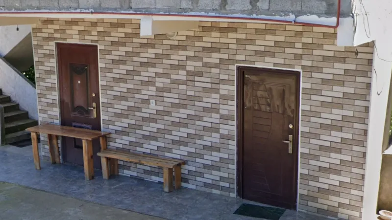
Walls decorated in a brick pattern, typically consisting of three different colours, are found mainly in the west of the country.
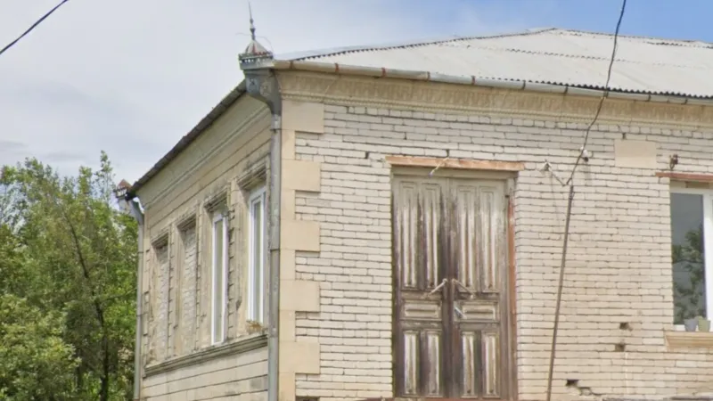
Houses with walls made entirely or partially of small white bricks are found primarily in Imereti.
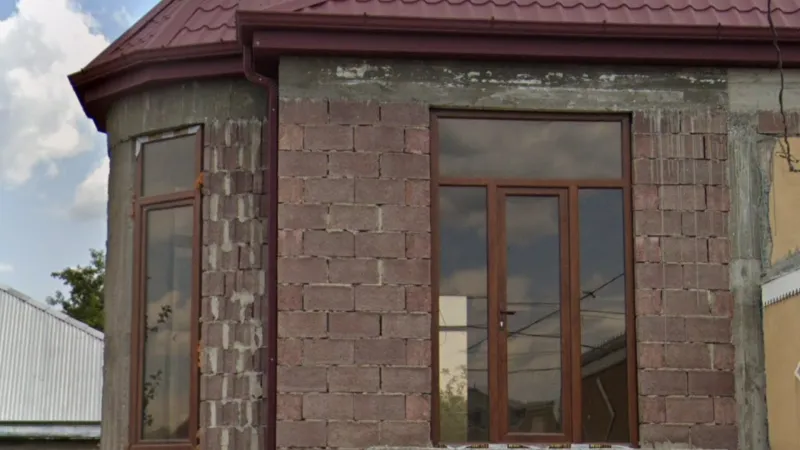
Houses built from pinkish-purple bricks, made from tuff volcanic rock, can be found in a southern belt extending to the west coast and are particularly common in Kvemo Kartli and Samtskhe-Javakheti.
Roof Features
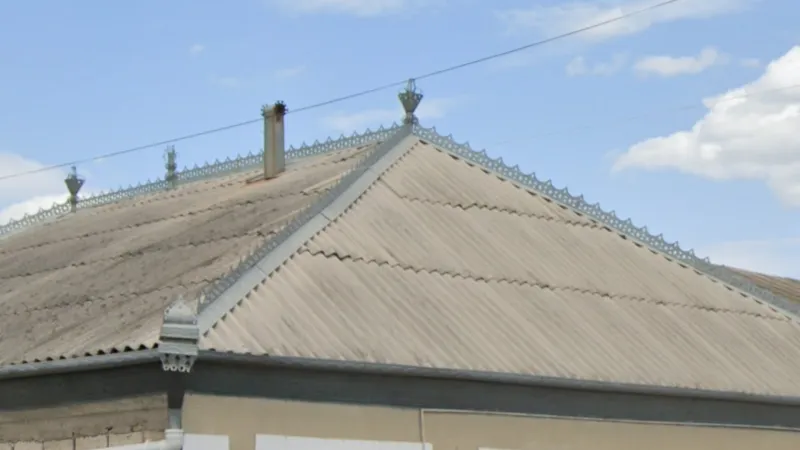
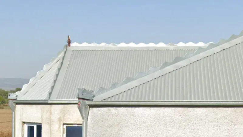
Metal ornamentation on roof ridges is commonly found in the southeast of the country. The style of this ornamentation can vary and may not run along the whole ridge of the roof.
Metal roof ridge ornaments with a sinusoidal wave shape are only found in and around Mughanlo in Kakheti.
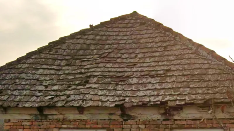
Flat clay roof tiles with rounded bottom edges are found primarily in this part of Kvemo Kartli.
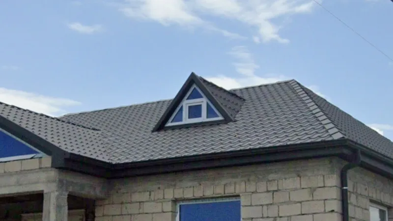
Houses with triangular dormers, usually with windows made from brightly coloured tinted glass, can be seen southeast of Tbilisi and around the town of Mughanlo in Kakheti. Tinted glass in general is also more common in this area than elsewhere in the country.
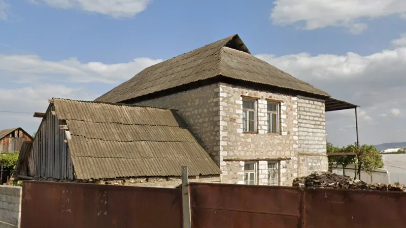
Small triangular gables above a hipped roof are often seen in the areas of southern Georgia marked on the map.
Fences
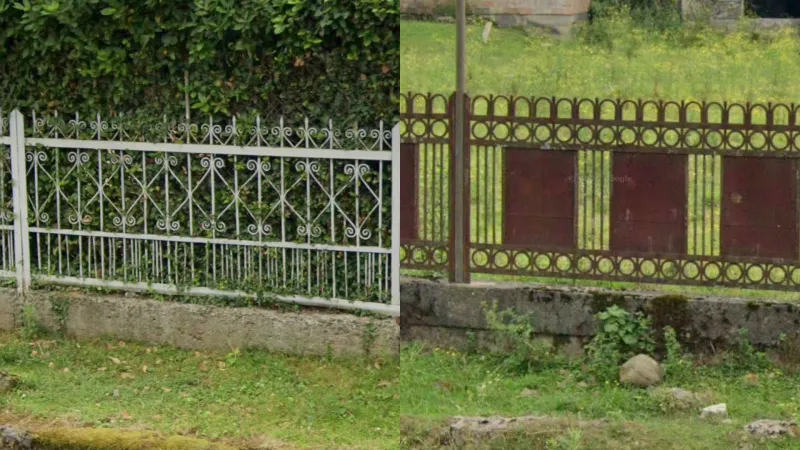
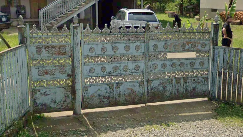
Lightweight decorative metal fences are very common in coastal regions of Georgia and, to a lesser extent, in Imereti.
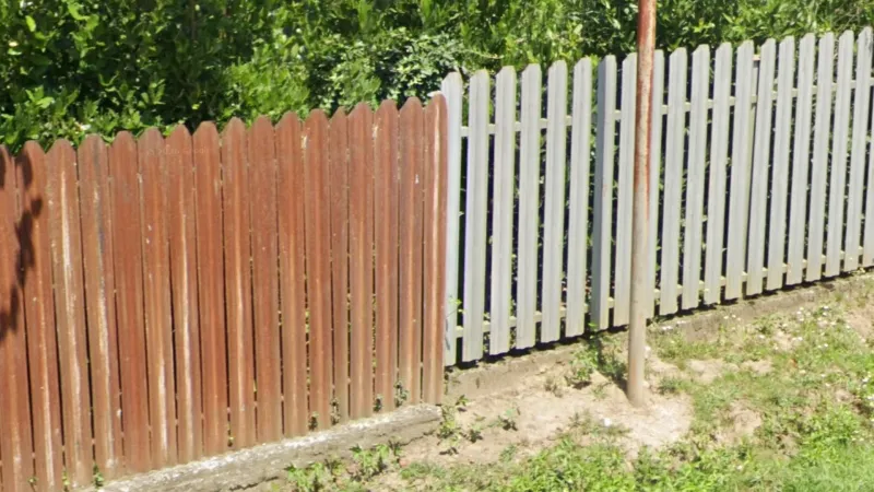
Metal picket fences, ranging in colour from white to brown, are very common around Zugdidi, near the border with Abkhazia. However, they may rarely be seen elsewhere in the west.
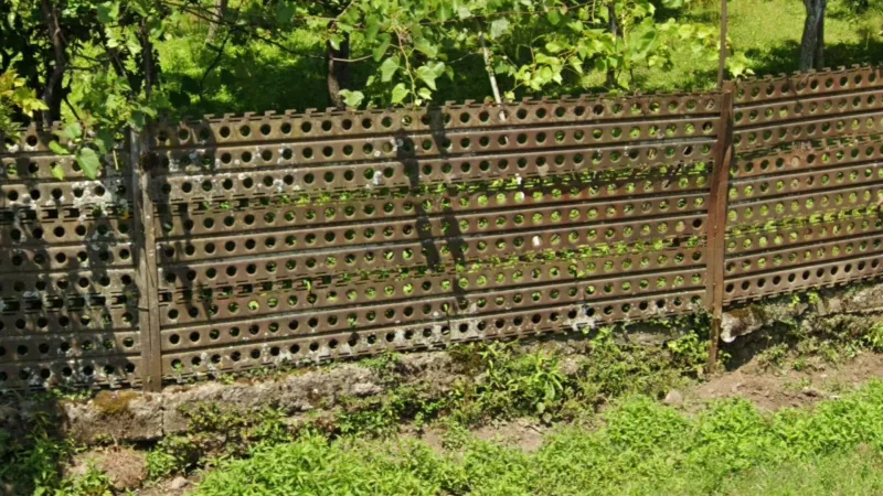
This style of metal fence with round holes is usually found in the parts of the coastal regions shown on the map.
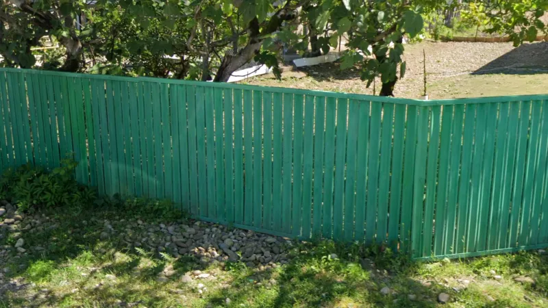
Metal picket fences with a top and bottom rail are most common in these parts of Imereti and Guria.
Gates and fences with specific types of ornaments can often be seen in and around Imereti. These include:
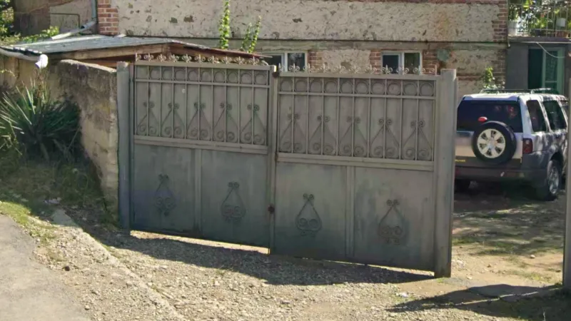
Gates with scrollwork mounted on a metal surface (so without holes in the scrollwork) are a good clue for the southeast of the country.
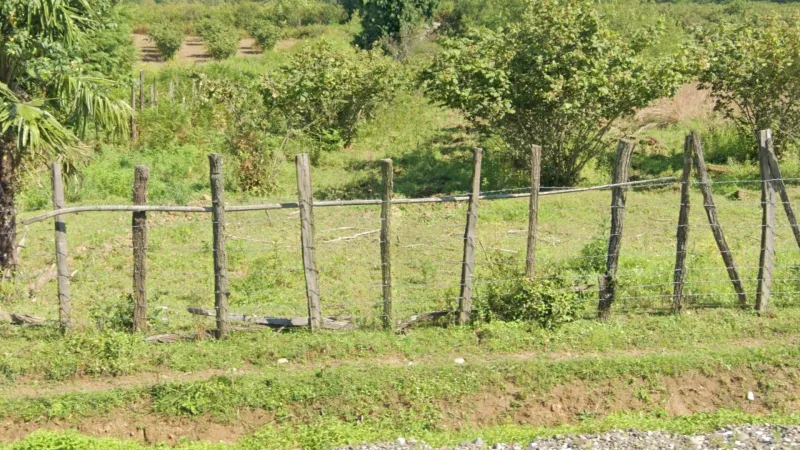
Fences made from irregular wooden poles, often connected with wires or sticks, are common in the coastal regions and Imereti.
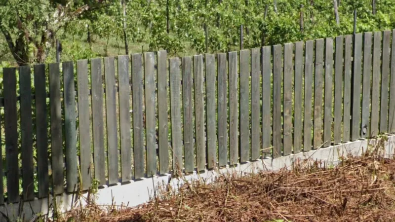
Picket fences made from wooden planks are most common in hilly and mountainous parts of western Georgia.
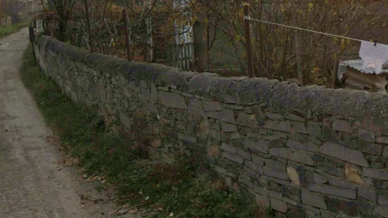
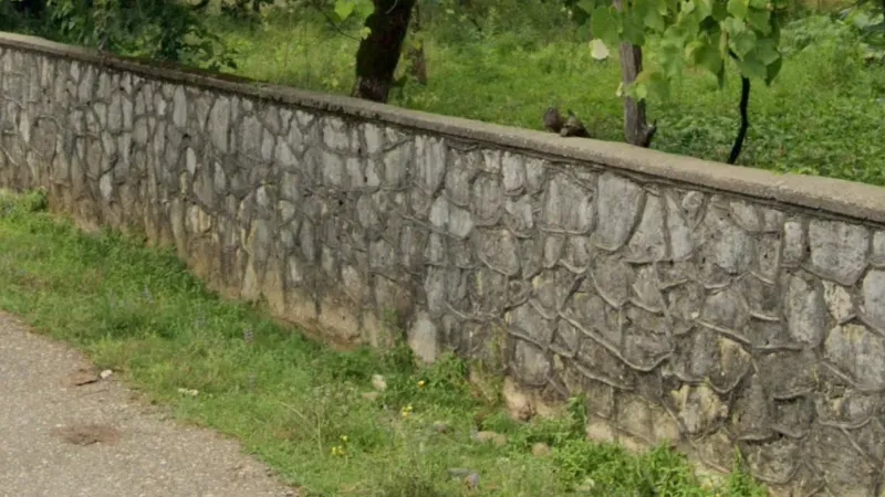
Walls with rough, rounded coping on top can be seen in Kvemo Kartli and Kakheti.
Walls with net-like mortar patterns can sometimes be seen near Zugdidi.
Miscellaneous
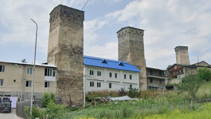
These distinctive stone towers are unique to the region of Svaneti in northwestern Georgia.
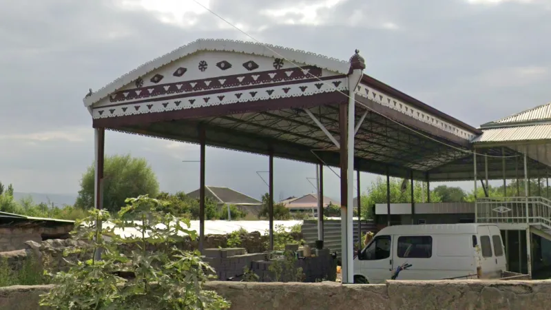
Open-air pavilions decorated with ornamental patterns can be seen adjacent to houses in this part of Kvemo Kartli.
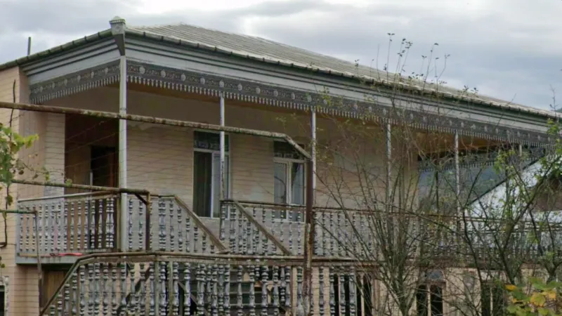
Intricate, decorative metal trim running along the edges of roofs, awnings and porches can be found primarily in Imereti. You can also see decorative metal awnings above external doors in this area. These awnings will often have a triangular gable shape and sometimes come in pairs.
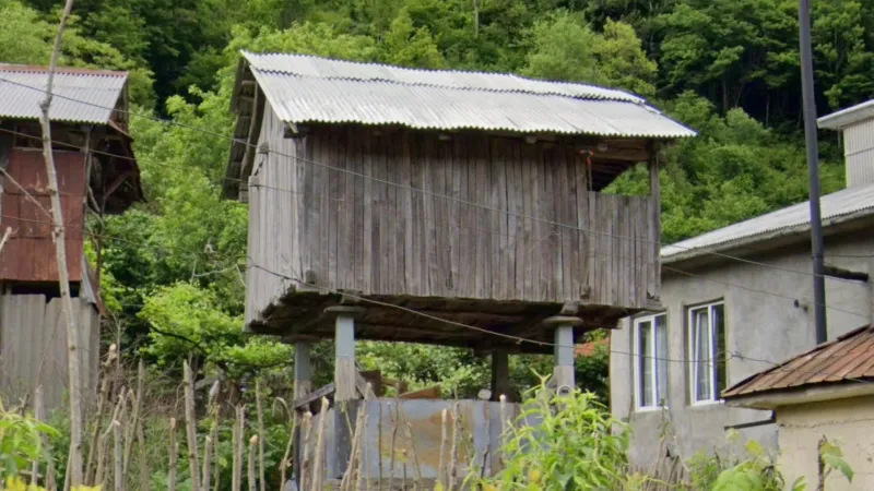
Small barns on strikingly high stilts are found particularly in Adjara and, more rarely, in other regions in the west of the country.
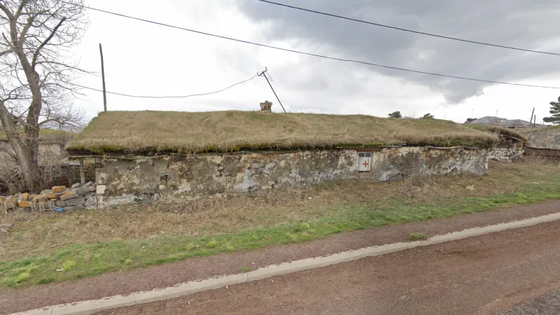
Low, long buildings with grass-covered roofs can sometimes be found in southeastern Samtskhe-Javakheti.
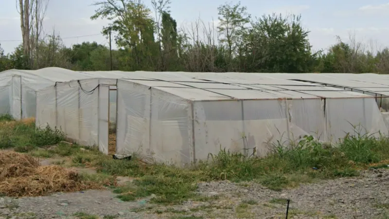
Greenhouses are found in various pockets from west to east, with the greatest concentration in the southeast of Kvemo Kartli.
Infrastructure
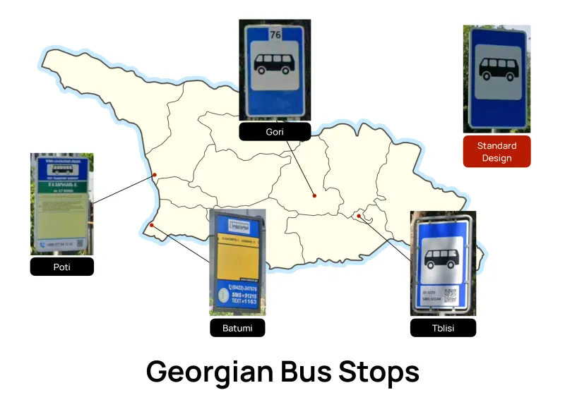
There is a standard bus stop design in Georgia which is non-regional. This is blue with a white rounded square containing a picture of a bus.Bus stops in Tbilisi follow this standard design but usually have a metal ‘Swiss-style’ frame around the bus stop, although they may have a partial frame instead. Bus stops there may also have an additional section containing a QR code. There are also various other regional designs:
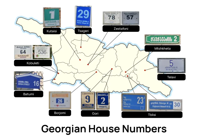
Many towns and cities in Georgia have particular designs of house number plates:
Tbilisi has a blue design with a white outline of a square in the bottom-right corner and another longer blue design with a white square section on the right.
Gori has two designs, each with the numeral written in a large font and the street name written in Georgian script and Latin script above and below the number.
Borjomi has a white design with the number in a blue rectangle, a yellow section above the number and a heart logo in the bottom row.
Batumi has a blue design in the shape of a house.
Kobuleti has two designs, one with a creamy-beige strip at the bottom and the other with a red-and-green logo in the bottom-left corner.
Kutaisi has a design featuring the numeral in a large font with the street name written below. The colour of the plate can vary but the style will be the same as the plate in the image.
Tsageri has a blue design with white text.
Zestafoni has a white design featuring an arc over some blue text at the bottom. On most plates, these are faded, but the plate design is still recognisable.
Mtskheta has a green design with a white frame and text.
Telavi has a white design with blue text.
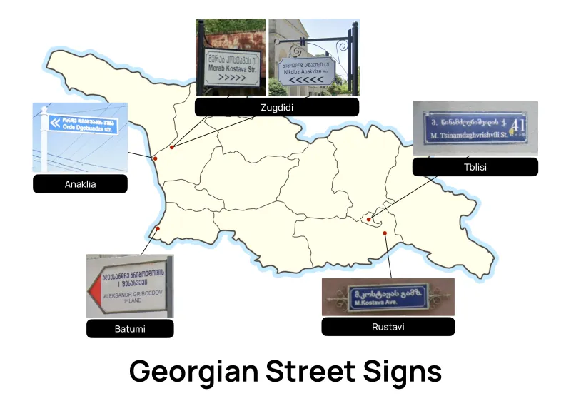
Some towns and cities in Georgia have distinctive street sign designs:
Batumi and the area to its southeast have arrow-shaped signs with a red tip. Sometimes the red colour on the tip is faded.
Anaklia has long, narrow blue signs with white text.
Zugdidi has white signs with notched corners that hang from a decorative bracket. Similar rectangular signs mounted on posts can be seen in the nearby area.
The old town of Tbilisi has dark blue street signs.
The old town of Rustavi has blue signs with a metal scrollwork decoration on each end. This decoration can also be seen on blue house number plates there.
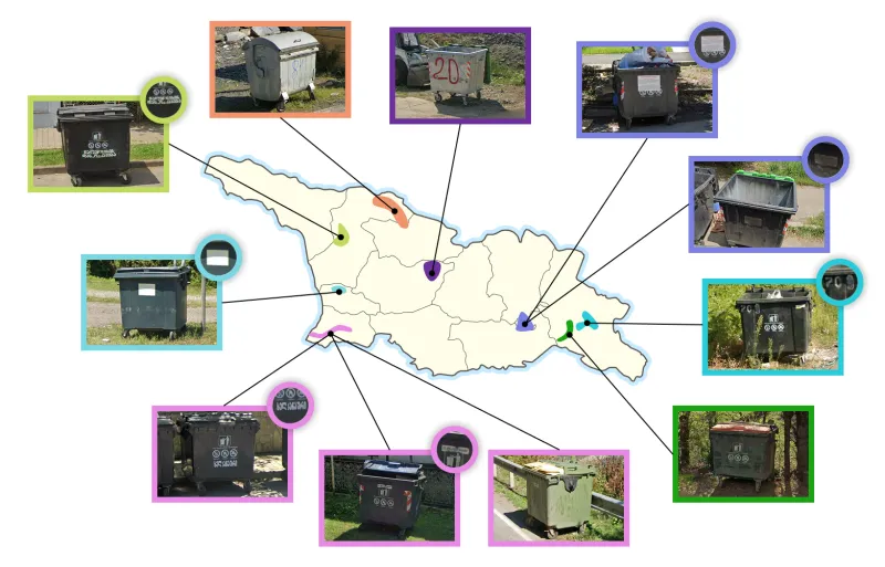
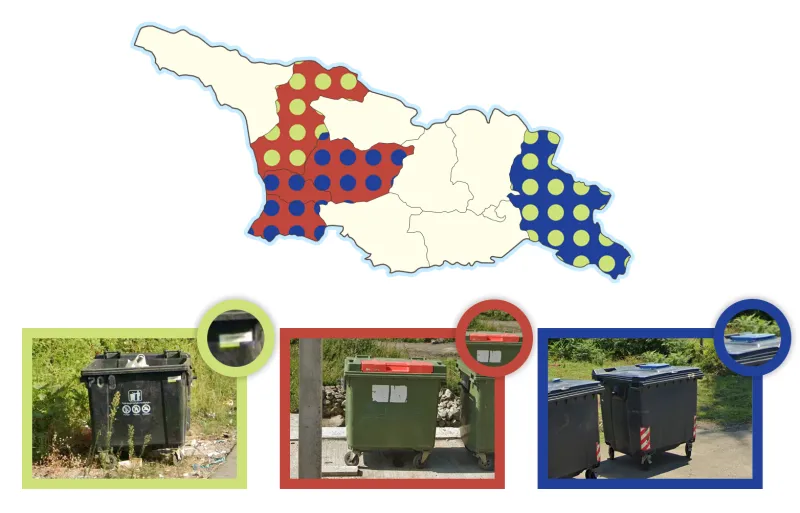
Bins around Tsalenjikha, Samegrelo Zemo-Svaneti, have a green sticker with bold white text on it (reads ‘Tsalenjikha Sanitation’ in Georgian).
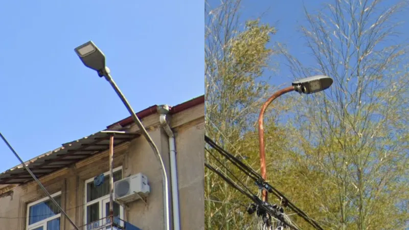
Batumi has two unique styles of lamps. The first is flat with a rectangular light while the second has a rounded, capsule shape.
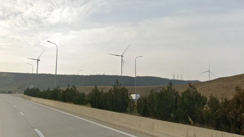
The only two wind farms in Georgia are both located in central Shida Kartli. One is northwest of Gori and the other southwest of Kaspi.
Culture & Language
Islam
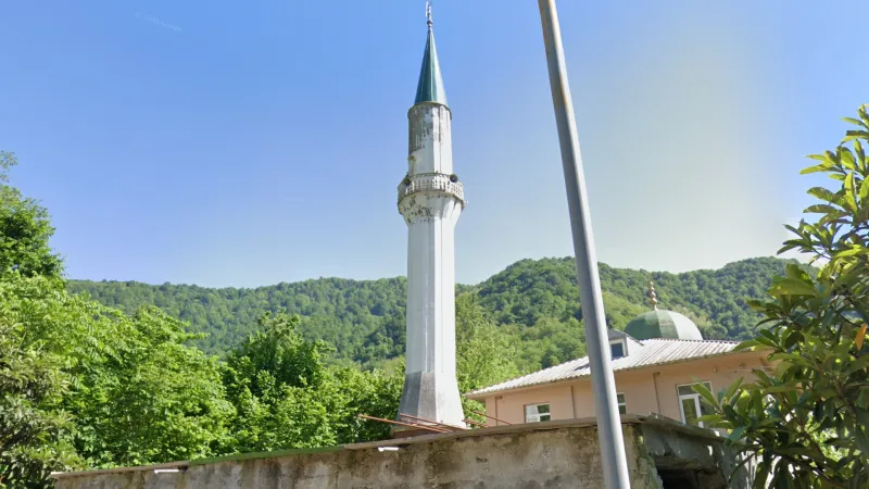
Islam is prevalent in two distinct areas of Georgia: Adjara where it is practised by Georgian Muslims, and Azeri minority areas, situated primarily in Kvemo Kartli.
Azeri
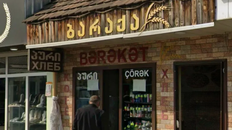
Georgia has a large Azeri minority located mostly within the Kvemo Kartli region and the town of Mughanlo in Kakheti. The Azeri language is frequently seen on signs in these areas. It closely resembles the Turkish language, with the notable addition of the unique ‘ə’ character to the standard Turkish letters like ‘ı’, ‘ş’, and ‘ü’. Town names in this area also feature suffixes of Azeri etymology, such as ‘-lo’ and ‘-kendi’.
Armenian
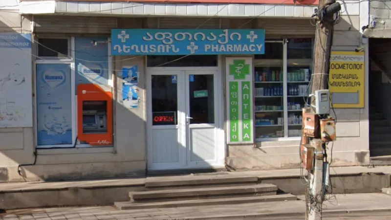
The Javakheti Plateau is home to a large Armenian community, with ethnic Armenians forming the majority in Ninotsminda and Akhalkalaki municipalities. Signs in the unique Armenian script can be found in this area, although bilingual Armenian translations are also common near Armenian border crossings outside the Javakheti Plateau.
-U Suffix
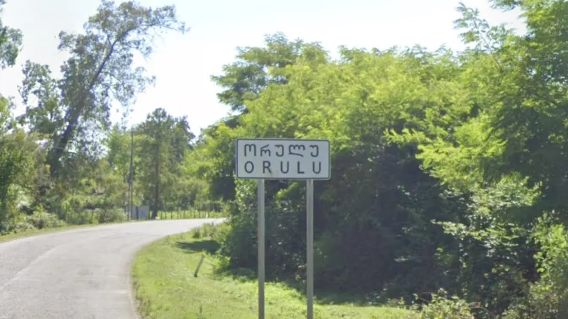
Place names ending in the letter ‘u’ (Georgian: ‘უ’) do not occur in the Georgian language, but can be found in Abkhaz-influenced areas near the Abkhaz border.
Adjara Flag
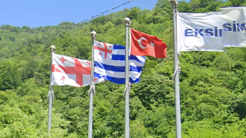
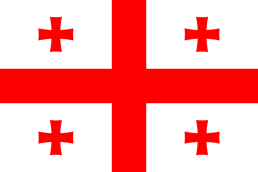
The autonomous region of Adjara in the southwest has its own flag which can sometimes be seen, particularly in Batumi. It resembles a Greek flag but with the Georgian flag in the top-left corner instead of a white cross.


 Georgia